IMAGES TAKEN NEAR TO
Wellpark Road, INVERURIE, AB51 0WD

Introduction

This page details the photographs taken nearby to Wellpark Road, AB51 0WD by members of the Geograph project.

The Geograph project started in 2005 with the aim of publishing, organising and preserving representative images for every square kilometre of Great Britain, Ireland and the Isle of Man.

There are currently over 7.5m images from over14,400 individuals and you can help contribute to the project by visiting https://www.geograph.org.uk

Image Map


Images are licensed for reuse under creativecommons.org/licenses/by-sa/2.0
Notes
  • Clicking on the map will re-center to the selected point.
  • The higher the marker number, the further away the image location is from the centre of the postcode.

Image Listing (40 Images Found)

Images are licensed for reuse under creativecommons.org/licenses/by-sa/2.0
  • ...
Image
Details
Distance
1
Council flats, Northern Road, Kintore
Image: © Bill Harrison Taken: 6 May 2012
0.04 miles
2
Forest Road, Kintore
View towards the Town House.
Image: © Richard Webb Taken: 5 Apr 2017
0.06 miles
3
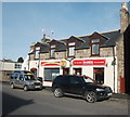
Kintore carry-outs...
...(as take-aways are referred to in Scotland).
Image: © Bill Harrison Taken: 19 Feb 2017
0.06 miles
4
Kintore Fire Station
Image: © Bill Harrison Taken: 19 Feb 2017
0.06 miles
5
Goosecroft House, Forest Road, Kintore
The former manse, dating from ca. 1784 and B-listed: http://portal.historicenvironment.scot/designation/LB36311. Now in private hands.
Image: © Bill Harrison Taken: 6 May 2012
0.06 miles
6
View south-east down the B987
From outside the Coop, with a large coffee cup indicating that you can get one inside if you so wished.
Image: © Angela Jones Taken: 2 Aug 2024
0.08 miles
7
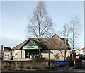
Kintore Co-Op
The village convenience store.
Image: © Bill Harrison Taken: 19 Feb 2017
0.08 miles
8
Kintore Tandoori
Even villages have their own curry house these days...
Image: © Bill Harrison Taken: 19 Feb 2017
0.08 miles
9
Former Station Hotel, Kintore
This imposing granite structure has 1899 on the date-stone; the station (closed in 1968, but proposed to reopen as part of the Inverness-Aberdeen line update) was just behind the building. Now flats. Note ashlar granite to the front and rougher blocks to the side.
Image: © Bill Harrison Taken: 19 Feb 2017
0.09 miles
10
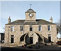
Town House, Kintore
Built ca. 1737-1749 and according to The Buildings of Scotland guide, "a classic of its kind." It multi-tasked as burgh council chamber, school, prison and girnal (grain store).
Image: © Bill Harrison Taken: 19 Feb 2017
0.09 miles
  • ...