IMAGES TAKEN NEAR TO
Kintore, INVERURIE, AB51 0UE
Introduction
This page details the photographs taken nearby to AB51 0UE by members of the Geograph project.
The Geograph project started in 2005 with the aim of publishing, organising and preserving representative images for every square kilometre of Great Britain, Ireland and the Isle of Man.

There are currently over 7.5m images from over14,400 individuals and you can help contribute to the project by visiting https://www.geograph.org.uk
Image Map
Images are licensed for reuse under creativecommons.org/licenses/by-sa/2.0
Notes
- Clicking on the map will re-center to the selected point.
- The higher the marker number, the further away the image location is from the centre of the postcode.
Image Listing (8 Images Found)
Images are licensed for reuse under creativecommons.org/licenses/by-sa/2.0
Image
Details
Distance
1
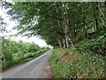
Road through Trees
Heading south east this road squeezes itself between a woodland belt and nearby rail line.
Image: © Andrew Wood
Taken: 7 Aug 2018
0.03 miles
2
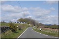
Brae Farm
The road sign warns of a blind summit.
Image: © Bill Harrison
Taken: 6 May 2012
0.04 miles
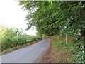
3
Brae Farm
Approaching Brae Farm on an unclassified road near Kintore.
Image: © Andrew Wood
Taken: 21 Aug 2020
0.04 miles
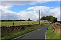
4
Leaving Kintore
A minor road to the south of Kintore on the limit of the village.
Image: © Andrew Wood
Taken: 2 Aug 2018
0.15 miles
5
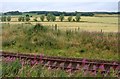
Line to Kintore
The Aberdeen to Inverness railway line heading towards Kintore.
Image: © Andrew Wood
Taken: 21 Aug 2020
0.15 miles
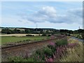
6
The railway north out of Aberdeen near Kintore
Image: © Alan Reid
Taken: 4 Aug 2017
0.21 miles
7
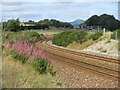
Railway heading to Kintore
Aberdeen to Inverness Railway Line curving towards Kintore, with Brae Farm ahead and Mither Tap in the far distance.
Image: © Scott Cormie
Taken: 25 Aug 2024
0.24 miles
8
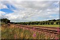
Sweep of Lines
The curving rail track just south of Kintore as they lead to Aberdeen.
Image: © Andrew Wood
Taken: 7 Aug 2018
0.25 miles