
IMAGES TAKEN NEAR TO
Alvah, BANFF, AB45 3UN
Introduction
This page details the photographs taken nearby to AB45 3UN by members of the Geograph project.
The Geograph project started in 2005 with the aim of publishing, organising and preserving representative images for every square kilometre of Great Britain, Ireland and the Isle of Man.

There are currently over 7.5m images from over14,400 individuals and you can help contribute to the project by visiting https://www.geograph.org.uk
Image Map
Images are licensed for reuse under creativecommons.org/licenses/by-sa/2.0
Notes
- Clicking on the map will re-center to the selected point.
- The higher the marker number, the further away the image location is from the centre of the postcode.
Image Listing (7 Images Found)
Images are licensed for reuse under creativecommons.org/licenses/by-sa/2.0
Image
Details
Distance
1
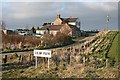
Little Itlaw
Despite what the sign says, this isn't Itlaw Farm - it's the neighbouring Little Itlaw. Itlaw is further up the road behind Little Itlaw.
Image: © Anne Burgess
Taken: 23 Mar 2007
0.02 miles
2
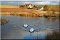
Little Itlaw
The swans here were uncharacteristically sociable - they headed towards me as soon as I appeared, and they followed me as I walked round the pond. The farm in the background is Little Itlaw.
Image: © Anne Burgess
Taken: 23 Mar 2007
0.02 miles
3
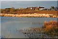
Itlaw
Evening sun catches Itlaw, picturesquely sited above a pond which wasn't there in 1967, according to the 1:50,000 map.
Image: © Anne Burgess
Taken: 23 Mar 2007
0.19 miles
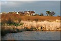
7
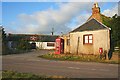
The Pole of Itlaw
The doors of the Mountblairy Arms stand open, and the signs outside still offer steaks, but the pub is derelict, and the adjacent house look empty as well.
Image: © Anne Burgess
Taken: 23 Mar 2007
0.23 miles