IMAGES TAKEN NEAR TO
Schoolhendry Street, BANFF, AB45 2RS
Introduction
This page details the photographs taken nearby to Schoolhendry Street, AB45 2RS by members of the Geograph project.
The Geograph project started in 2005 with the aim of publishing, organising and preserving representative images for every square kilometre of Great Britain, Ireland and the Isle of Man.

There are currently over 7.5m images from over14,400 individuals and you can help contribute to the project by visiting https://www.geograph.org.uk
Image Map
Images are licensed for reuse under creativecommons.org/licenses/by-sa/2.0
Notes
- Clicking on the map will re-center to the selected point.
- The higher the marker number, the further away the image location is from the centre of the postcode.
Image Listing (318 Images Found)
Images are licensed for reuse under creativecommons.org/licenses/by-sa/2.0
Image
Details
Distance
1
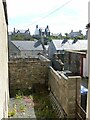
A view between, off North High Street, Portsoy
Looking across to Harbour View House (which in practice has very little view of the harbour!).
Image: © Alan Murray-Rust
Taken: 23 May 2022
0.03 miles
2
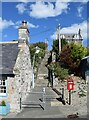
Gillans Steps, Portsoy
The steps connect Church Street in the foreground with the unusually named Schoolhendry Street at the top.
Image: © Bill Harrison
Taken: 10 Aug 2022
0.04 miles
3
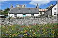
More wildflowers by the wall, Portsoy
Image: © Bill Harrison
Taken: 10 Aug 2022
0.05 miles
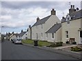
5
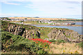
Portsoy from the East
Looking across Links Bay from the path to East Head. The red flowers are what I used to call Montbretia but which I now gather are actually called Crocosmia. I do not know which variety of Crocosmia - it seems that there are several.
Image: © Anne Burgess
Taken: 15 Aug 2017
0.06 miles
6
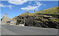
Rocky outcrop, Shore Street, Portsoy
The British Geological Society interactive map identifies the tough black rocks as part of the Portsoy igneous complex (sheared metagabbro), being metamorphic bedrock formed between 485.4 and 443.8 million years ago during the Ordovician period.
Image: © Bill Harrison
Taken: 10 Aug 2022
0.07 miles
7
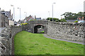
Former Railway Bridge
A branch line carved its way through the old town, terminating where I am standing. The former trackbed is now a path.
Image: © Anne Burgess
Taken: 22 Jul 2014
0.07 miles
8
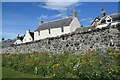
Wildflowers by the wall, Portsoy
54 Church Street on the other side of the wall dates from the late 18th Century and is C-listed (LB40229 http://portal.historicenvironment.scot/designation/LB40229 ).
Image: © Bill Harrison
Taken: 10 Aug 2022
0.07 miles