IMAGES TAKEN NEAR TO
Boyndie Street West, BANFF, AB45 1EP

Introduction

This page details the photographs taken nearby to Boyndie Street West, AB45 1EP by members of the Geograph project.

The Geograph project started in 2005 with the aim of publishing, organising and preserving representative images for every square kilometre of Great Britain, Ireland and the Isle of Man.

There are currently over 7.5m images from over14,400 individuals and you can help contribute to the project by visiting https://www.geograph.org.uk

Image Map


Images are licensed for reuse under creativecommons.org/licenses/by-sa/2.0
Notes
  • Clicking on the map will re-center to the selected point.
  • The higher the marker number, the further away the image location is from the centre of the postcode.

Image Listing (6 Images Found)

Images are licensed for reuse under creativecommons.org/licenses/by-sa/2.0
Image
Details
Distance
1
Pampas Grass
I hadn't noticed how much pampas grass there is in the new gardens by the A98 entering Banff, but they caught my eye this morning with the sun behind them.
Image: © Anne Burgess Taken: 19 Sep 2007
0.16 miles
2
Pampas Grass
It's not nearly as eye-catching with the sun on it as it is against the light in Image]
Image: © Anne Burgess Taken: 19 Sep 2007
0.17 miles
3
Banff Bay is just visible through the trees.
Image: © Des Colhoun Taken: 13 Sep 2006
0.19 miles
4
Seafront, Banff
Beachside houses beneath steep slopes. A railway once ran along here.
Image: © Richard Webb Taken: 5 Aug 2011
0.20 miles
5
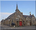
Banff Methodist church
Dating from 1877 and C-listed (LB22093): http://portal.historicenvironment.scot/designation/LB22093 .
Image: © Bill Harrison Taken: 14 Apr 2018
0.22 miles
6
St Catherine's Street
The sunlit north side of the street is a row of fine plain traditional houses.
Image: © Anne Burgess Taken: 25 Jul 2014
0.25 miles