IMAGES TAKEN NEAR TO
Smith Road, BANFF, AB45 1BN

Introduction

This page details the photographs taken nearby to Smith Road, AB45 1BN by members of the Geograph project.

The Geograph project started in 2005 with the aim of publishing, organising and preserving representative images for every square kilometre of Great Britain, Ireland and the Isle of Man.

There are currently over 7.5m images from over14,400 individuals and you can help contribute to the project by visiting https://www.geograph.org.uk

Image Map


Images are licensed for reuse under creativecommons.org/licenses/by-sa/2.0
Notes
  • Clicking on the map will re-center to the selected point.
  • The higher the marker number, the further away the image location is from the centre of the postcode.

Image Listing (15 Images Found)

Images are licensed for reuse under creativecommons.org/licenses/by-sa/2.0
Image
Details
Distance
1
Wilson's Academy
The classical building was designed by William Robertson and dates from 1837. The main portico has six Ionic columns, and the end pavilions have Corinthian columns. Originally it housed both the Academy and the Museum belonging to the Banff Institution for Science, Literature and the Arts. It still houses Banff Primary School, but secondary pupils now have to make do with much less uplifting architecture.
Image: © Anne Burgess Taken: 25 Jul 2014
0.19 miles
2
Sandyhill Road
Eighteenth century houses line the east side of Sandyhill Road. The nearest house is 20th century.
Image: © Anne Burgess Taken: 25 Jul 2014
0.19 miles
3
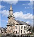
A Church in Banff.
Image: © Des Colhoun Taken: 13 Sep 2006
0.20 miles
4
3 and 5 High Street
The house on the right, No 5, with the Victorian rustic porch, was at one time the town house of Lord Banff. The porch on No 3 is more classical in style, but the houses themselves date from the early 1760s.
Image: © Anne Burgess Taken: 25 Jul 2014
0.22 miles
5
High Street, Banff
Looking into the town centre with the side of the parish kirk on the right.
Image: © Stephen McKay Taken: 28 May 2011
0.22 miles
6
A98 and Banff Parish Church
Image: © Peter Bond Taken: 11 Nov 2014
0.22 miles
7
31 - 39 High Street
These are early 18th century houses. The arched pend is very typical of Banff, and the sloping dormer windows are also traditional.
Image: © Anne Burgess Taken: 25 Jul 2014
0.23 miles
8
Banff Parish Church
Well described by Anne Burgess here: Image
Image: © Richard Webb Taken: 5 Aug 2011
0.23 miles
9
Banff parish kirk
The fine B-listed (LB22029: http://portal.historicenvironment.scot/designation/LB22029 ) parish kirk dating from 1790 (tower and spire added 1829) dominates the town.
Image: © Bill Harrison Taken: 14 Apr 2018
0.23 miles
10
Shoemaker's Land, 45 - 47 High Street
This early 18th century building may have been in use as a Trades Hall. It was converted into three houses in 1975 by the Banff Preservation Trust. See also Image
Image: © Anne Burgess Taken: 25 Jul 2014
0.24 miles