IMAGES TAKEN NEAR TO
Waul Park, FRASERBURGH, AB43 9SH
Introduction
This page details the photographs taken nearby to Waul Park, AB43 9SH by members of the Geograph project.
The Geograph project started in 2005 with the aim of publishing, organising and preserving representative images for every square kilometre of Great Britain, Ireland and the Isle of Man.

There are currently over 7.5m images from over14,400 individuals and you can help contribute to the project by visiting https://www.geograph.org.uk
Image Map
Images are licensed for reuse under creativecommons.org/licenses/by-sa/2.0
Notes
- Clicking on the map will re-center to the selected point.
- The higher the marker number, the further away the image location is from the centre of the postcode.
Image Listing (14 Images Found)
Images are licensed for reuse under creativecommons.org/licenses/by-sa/2.0
Image
Details
Distance
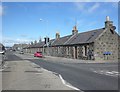
3
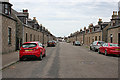
George Street
A broad street in the planned village of Broadsea, George Street was laid out in 1893. Until 1872 Broadsea was not part of Fraserburgh, and while Fraserburgh was mainly a trading port, the fishing fleet operated out of Broadsea until the 1830s.
Image: © Anne Burgess
Taken: 30 Aug 2016
0.13 miles
4
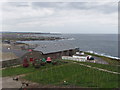
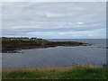
North Aberdeenshire coast at Fraserburgh
View from Kinnaird Head lighthouse. In the foreground are poles for fish drying lines, and some buoys which are part of the lighthouse museum. Next is Stale Head, still in Fraserburgh. Low coastline beyond is near Rosehearty. Beyond again is probably Troup Head.
Image: © David Hawgood
Taken: 11 Sep 2007
0.14 miles
5
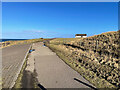
Broadsea Prom
An area of Fraserburgh called Broadsea and the sea path which follows the coast.
Image: © Ralph Greig
Taken: 20 Feb 2022
0.19 miles
6
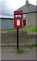
Elizabethan postbox on Watermill Road, Fraserburgh
Postbox No. AB43 6.
See Image] for context.
Image: © JThomas
Taken: 22 Aug 2020
0.19 miles
7
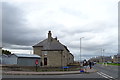
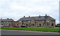
Houses on Watermill Road, Fraserburgh
Showing position of Postbox No. AB43 6.
See Image] for postbox.
Image: © JThomas
Taken: 22 Aug 2020
0.20 miles
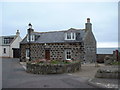
8
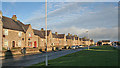
Watermill Road
There is a row of council-built houses on the north side of Watermill Road. They are much more pleasing to look at than the average council estate, being solidly built of stone and with interesting architectural detail
Image: © Anne Burgess
Taken: 6 Jan 2015
0.20 miles