IMAGES TAKEN NEAR TO
Rathen, FRASERBURGH, AB43 8XA
Introduction
This page details the photographs taken nearby to AB43 8XA by members of the Geograph project.
The Geograph project started in 2005 with the aim of publishing, organising and preserving representative images for every square kilometre of Great Britain, Ireland and the Isle of Man.

There are currently over 7.5m images from over14,400 individuals and you can help contribute to the project by visiting https://www.geograph.org.uk
Image Map
Images are licensed for reuse under creativecommons.org/licenses/by-sa/2.0
Notes
- Clicking on the map will re-center to the selected point.
- The higher the marker number, the further away the image location is from the centre of the postcode.
Image Listing (10 Images Found)
Images are licensed for reuse under creativecommons.org/licenses/by-sa/2.0
Image
Details
Distance
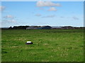
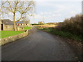
3
Minor road, Little Invernorth
Towards Invernorth.
Image: © JThomas
Taken: 24 Aug 2020
0.13 miles
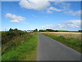
6
Minor road at Invernorth
Looking north-eastward.
Image: © Peter Wood
Taken: 20 Nov 2019
0.22 miles
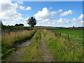
8
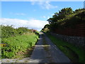
Minor road, Muiries Hill
Towards Cairnbulg Mains.
Image: © JThomas
Taken: 24 Aug 2020
0.23 miles
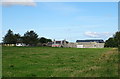
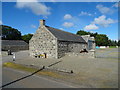
10
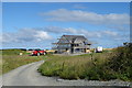
New house under construction, Muiries Hill
Image: © JThomas
Taken: 24 Aug 2020
0.25 miles