IMAGES TAKEN NEAR TO
St. Drostans Lane, FRASERBURGH, AB43 6LN

Introduction

This page details the photographs taken nearby to St. Drostans Lane, AB43 6LN by members of the Geograph project.

The Geograph project started in 2005 with the aim of publishing, organising and preserving representative images for every square kilometre of Great Britain, Ireland and the Isle of Man.

There are currently over 7.5m images from over14,400 individuals and you can help contribute to the project by visiting https://www.geograph.org.uk

Image Map


Images are licensed for reuse under creativecommons.org/licenses/by-sa/2.0
Notes
  • Clicking on the map will re-center to the selected point.
  • The higher the marker number, the further away the image location is from the centre of the postcode.

Image Listing (24 Images Found)

Images are licensed for reuse under creativecommons.org/licenses/by-sa/2.0
  • ...
Image
Details
Distance
1
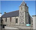
New Aberdour village hall
Built ca. 1892 with clocktower added later.
Image: © Bill Harrison Taken: 16 Apr 2021
0.11 miles
2
The Church of Scotland in New Aberdour.
Image: © Des Colhoun Taken: 26 Nov 2006
0.11 miles
3
New Aberdour Village Hall
Though just as difficult to photograph as seven years ago (see Image]) this does possibly give a slightly better view of it. Late Victorian, it was opened by the Earl of Aberdeen in 1892 and extended later.
Image: © Anne Burgess Taken: 20 Jan 2017
0.11 miles
4
Informative Bus Shelter
The outside of the bus shelter in New Aberdour has panels explaining the significance of the unicorn and the thistle in Scottish folklore and history.
Image: © Anne Burgess Taken: 16 Sep 2024
0.11 miles
5
Bus Stop and Toilets
I know they are essential amenities, but the siting and design of these are utterly insensitive. Why could the toilets not have been built on the other side of the street, where they would not have intruded so grossly between the parish kirk and the village hall? Or, if absolutely they had to go here, could they not have been built in a style more sympathetic to the neighbouring buildings? The bus stop, on its own, isn't quite so ugly. Edit: The bus stop has been decorated since I took this shot. See Image
Image: © Anne Burgess Taken: 20 Jan 2017
0.11 miles
6
New Aberdour Village Hall
This severe granite building is all but impossible to photograph well, thanks to the quite extraordinarily insensitive siting of the public toilets, an ugly concrete box, right by the road between the kirk and the hall. A corner of the toilet block intrudes at lower right in this image, and the blue plastic skip does nothing to enhance the view either.
Image: © Anne Burgess Taken: 2 Jul 2009
0.12 miles
7
Patriotic bus shelter
It looks a bit smarter than when Anne Burgess photographed it four years previously: https://www.geograph.org.uk/photo/5259244 .
Image: © Bill Harrison Taken: 16 Apr 2021
0.12 miles
8
High Street in New Aberdour
Looking south-westward. A complementary view of High Street can be seen in : https://www.geograph.org.uk/photo/6328691
Image: © Peter Wood Taken: 19 Nov 2019
0.13 miles
9
Fountain at the junction...
...of the High Street and Elphin Street (the B9031), New Aberdour. It was once at the centre of the village market.
Image: © Bill Harrison Taken: 16 Apr 2021
0.13 miles
10
Aberdour Parish Kirk
This building dates from 1818, and was built here to serve the new village created by William Gordon in 1798. It is attibuted to Aberdeen architect John Smith (1781-1852). Like its now ruined predecessor it is dedicated to St Drostan. The little porch at this end bears the date 1885.
Image: © Anne Burgess Taken: 2 Jul 2009
0.13 miles
  • ...