IMAGES TAKEN NEAR TO
Knock View Place, PETERHEAD, AB42 5TR

Introduction

This page details the photographs taken nearby to Knock View Place, AB42 5TR by members of the Geograph project.

The Geograph project started in 2005 with the aim of publishing, organising and preserving representative images for every square kilometre of Great Britain, Ireland and the Isle of Man.

There are currently over 7.5m images from over14,400 individuals and you can help contribute to the project by visiting https://www.geograph.org.uk

Image Map


Images are licensed for reuse under creativecommons.org/licenses/by-sa/2.0
Notes
  • Clicking on the map will re-center to the selected point.
  • The higher the marker number, the further away the image location is from the centre of the postcode.

Image Listing (6 Images Found)

Images are licensed for reuse under creativecommons.org/licenses/by-sa/2.0
Image
Details
Distance
1
Stuartfield Lake
Image: © Ralph Greig Taken: 6 Jul 2023
0.13 miles
2
Millpond, Stuartfield
It seems that the millpond once served a waulkmill (cloth fulling mill) about 100 metres to the east but it now has an ornamental function. Stuartfield Free Church was sited approximately where the white house on the left now sits.
Image: © Bill Harrison Taken: 22 May 2021
0.15 miles
3
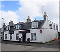
Crichie Inn, Stuartfield.
The local pub carries the former village name. It sits on the road northwards, to the Quartalehouse end of Stuartfield.
Image: © Colin Smith Taken: 18 Apr 2006
0.21 miles
4
Contrasting dwellings, Burnett Street, Stuartfield
Note the asymmetric door placement in the left-hand building.
Image: © Bill Harrison Taken: 22 May 2021
0.21 miles
5
Reinventing the village inn...
...as a bar and Chinese restaurant.
Image: © Bill Harrison Taken: 22 May 2021
0.24 miles
6
Village garage, Stuartfield
The pumps are long gone but the garage on the main street of the village, which sits between houses, lives on by offering servicing and MOTs.
Image: © Bill Harrison Taken: 22 May 2021
0.24 miles