
IMAGES TAKEN NEAR TO
Inn Brae, PETERHEAD, AB42 4XN
Introduction
This page details the photographs taken nearby to Inn Brae, AB42 4XN by members of the Geograph project.
The Geograph project started in 2005 with the aim of publishing, organising and preserving representative images for every square kilometre of Great Britain, Ireland and the Isle of Man.

There are currently over 7.5m images from over14,400 individuals and you can help contribute to the project by visiting https://www.geograph.org.uk
Image Map
Images are licensed for reuse under creativecommons.org/licenses/by-sa/2.0
Notes
- Clicking on the map will re-center to the selected point.
- The higher the marker number, the further away the image location is from the centre of the postcode.
Image Listing (42 Images Found)
Images are licensed for reuse under creativecommons.org/licenses/by-sa/2.0
Image
Details
Distance
1
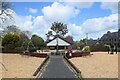
Looking into the playpark, Inn Brae, Longside
Possibly funded as a developer contribution to accommodate new housing?
Image: © Bill Harrison
Taken: 22 May 2021
0.03 miles
2
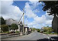
Looking down Inn Brae, Longside...
...with the church hall to the left.
Image: © Bill Harrison
Taken: 22 May 2021
0.04 miles
4
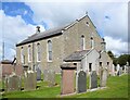
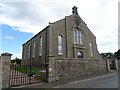
Longside parish kirk
Built 1836 to replace the 1620 kirk just to the south and designed by John Smith. B-listed (LB9411): http://portal.historicenvironment.scot/designation/LB9411 .
Image: © Bill Harrison
Taken: 22 May 2021
0.05 miles
5
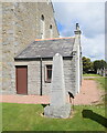
Jamie Fleeman memorial obelisk, Longside kirkyard
According to Jervise: erected in 1861 to indicate the grave of local character Jamie Fleeman, in answer to his prayer — "Dinna bury me like a beast". This singular being was born at Ludquharn in 1713, and died at Kinmundy in 1778. His remarkable sayings and doings are narrated in an interesting pamphlet entitled The Life and Death of Jamie Fleeman, the Laird of Udny's Fool, by Rev. Dr John Pratt, Episcopal minister, Cruden. Remarkably, this obscure document is available as a free download from archive.org https://archive.org/details/lifedeathofjamie00prat/page/8/mode/2up
Image: © Bill Harrison
Taken: 22 May 2021
0.05 miles
6
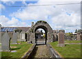
Entrance arch, Longside kirkyard
Dated 1705 but possibly erected with the church in 1620. A-listed (LB9412;
http://portal.historicenvironment.scot/designation/LB9412 ) for its rarity; compare a similar arch at Chapel of Garioch, some 40 km to the southwest: https://www.geograph.org.uk/photo/4647329 .
Image: © Bill Harrison
Taken: 22 May 2021
0.05 miles
7
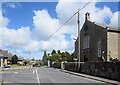
Junction of Inn Brae and Inverquhomery Road, Longside...
...with the parish kirk to the right. Inverquhomery means 'infall of the burn formed by the union of two other burns' according to Celtic Place-names in Aberdeenshire by John Milne.
Image: © Bill Harrison
Taken: 22 May 2021
0.05 miles
8
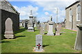
War grave, Longside kirkyard
Andrew Kilgour, who apparently died at Longside aged 17 or 18 and a separate grave to the Longside war memorial.
Image: © Bill Harrison
Taken: 22 May 2021
0.05 miles
9
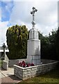
Longside war memorial
Erected 1922, designed by William Kelly: 75 names of the fallen in WWI, 11 in WWII and one in Cyprus in 1956.
Image: © Bill Harrison
Taken: 22 May 2021
0.05 miles
10
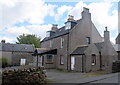
Former Bruce Arms Hotel, Longside
Dating from ca. 1840 and just meriting a C-listing: http://portal.historicenvironment.scot/designation/LB9415 . Now in residential use.
Image: © Bill Harrison
Taken: 22 May 2021
0.05 miles