
IMAGES TAKEN NEAR TO
Church Lane, PETERHEAD, AB42 4TJ
Introduction
This page details the photographs taken nearby to Church Lane, AB42 4TJ by members of the Geograph project.
The Geograph project started in 2005 with the aim of publishing, organising and preserving representative images for every square kilometre of Great Britain, Ireland and the Isle of Man.

There are currently over 7.5m images from over14,400 individuals and you can help contribute to the project by visiting https://www.geograph.org.uk
Image Map
Images are licensed for reuse under creativecommons.org/licenses/by-sa/2.0
Notes
- Clicking on the map will re-center to the selected point.
- The higher the marker number, the further away the image location is from the centre of the postcode.
Image Listing (33 Images Found)
Images are licensed for reuse under creativecommons.org/licenses/by-sa/2.0
Image
Details
Distance
1
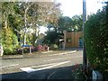
Longside telephone exchange
Longside has a telephone exchange of the wooden shed variety, nestling behind a building with lighter coloured wooden cladding that was once a greengrocery.
Image: © Haworth Hodgkinson
Taken: 17 Oct 2016
0.04 miles
4
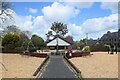
Looking into the playpark, Inn Brae, Longside
Possibly funded as a developer contribution to accommodate new housing?
Image: © Bill Harrison
Taken: 22 May 2021
0.11 miles
5
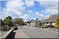
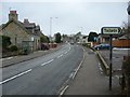
Village junction
The main road junction in the centre of Longside village, where Inn Brae (left) and Station Road (right) meet the A950. The house at the Station Road corner is B-listed: http://portal.historicenvironment.scot/designation/LB9416 .
Image: © Bill Harrison
Taken: 22 May 2021
0.11 miles
6
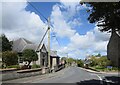
Looking down Inn Brae, Longside...
...with the church hall to the left.
Image: © Bill Harrison
Taken: 22 May 2021
0.11 miles
7
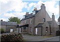
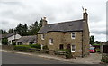
Former Bruce Arms Hotel, Longside
Dating from ca. 1840 and just meriting a C-listing: http://portal.historicenvironment.scot/designation/LB9415 . Now in residential use.
Image: © Bill Harrison
Taken: 22 May 2021
0.12 miles
8
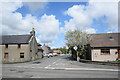
Station Road, Longside
The station, located several hundred metres north of the village saw its last passenger train in 1965, but the name remains.
Image: © Bill Harrison
Taken: 22 May 2021
0.15 miles
9
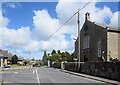
Junction of Inn Brae and Inverquhomery Road, Longside...
...with the parish kirk to the right. Inverquhomery means 'infall of the burn formed by the union of two other burns' according to Celtic Place-names in Aberdeenshire by John Milne.
Image: © Bill Harrison
Taken: 22 May 2021
0.15 miles
10
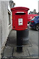
Elizabethan postbox on Main Street, Longside
Outside the Post Office.
Postbox No. AB42 24.
See Image] for context.
Image: © JThomas
Taken: 22 Aug 2020
0.15 miles