IMAGES TAKEN NEAR TO
Mintlaw, PETERHEAD, AB42 4LH
Introduction
This page details the photographs taken nearby to AB42 4LH by members of the Geograph project.
The Geograph project started in 2005 with the aim of publishing, organising and preserving representative images for every square kilometre of Great Britain, Ireland and the Isle of Man.

There are currently over 7.5m images from over14,400 individuals and you can help contribute to the project by visiting https://www.geograph.org.uk
Image Map
Images are licensed for reuse under creativecommons.org/licenses/by-sa/2.0
Notes
- Clicking on the map will re-center to the selected point.
- The higher the marker number, the further away the image location is from the centre of the postcode.
Image Listing (4 Images Found)
Images are licensed for reuse under creativecommons.org/licenses/by-sa/2.0
Image
Details
Distance
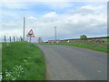
2
C2B road
Looking back to Auchmachar Lodge
Image: © Les Harvey
Taken: 7 May 2007
0.16 miles
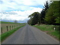
3
North Auchmachar
The house at North Auchmachar looks as if it dates from the 18th century, and the buildings are sensibly sited north of the house, which has an uninterrupted view to the south.
Image: © Anne Burgess
Taken: 7 May 2015
0.16 miles