IMAGES TAKEN NEAR TO
Cruden Bay, PETERHEAD, AB42 0PQ
Introduction
This page details the photographs taken nearby to AB42 0PQ by members of the Geograph project.
The Geograph project started in 2005 with the aim of publishing, organising and preserving representative images for every square kilometre of Great Britain, Ireland and the Isle of Man.

There are currently over 7.5m images from over14,400 individuals and you can help contribute to the project by visiting https://www.geograph.org.uk
Image Map
Images are licensed for reuse under creativecommons.org/licenses/by-sa/2.0
Notes
- Clicking on the map will re-center to the selected point.
- The higher the marker number, the further away the image location is from the centre of the postcode.
Image Listing (15 Images Found)
Images are licensed for reuse under creativecommons.org/licenses/by-sa/2.0
Image
Details
Distance
3
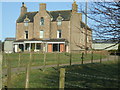
The Cottage, Aldie
More of a modern bungalow.
Image: © JThomas
Taken: 23 Aug 2020
0.11 miles
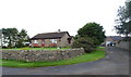
8
Aldie Farm entrance gate
A touch of grandeur compared with most of the local farms!
Image: © Ken Fitlike
Taken: 8 Mar 2007
0.13 miles
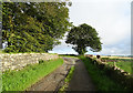
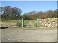
10
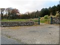
Green Gates
The green gates of Aldie Farm its grander eastern entrance.
Image: © Andrew Wood
Taken: 18 Nov 2018
0.14 miles