
IMAGES TAKEN NEAR TO
Ardmachron Drive, PETERHEAD, AB42 0HR
Introduction
This page details the photographs taken nearby to Ardmachron Drive, AB42 0HR by members of the Geograph project.
The Geograph project started in 2005 with the aim of publishing, organising and preserving representative images for every square kilometre of Great Britain, Ireland and the Isle of Man.

There are currently over 7.5m images from over14,400 individuals and you can help contribute to the project by visiting https://www.geograph.org.uk
Image Map
Images are licensed for reuse under creativecommons.org/licenses/by-sa/2.0
Notes
- Clicking on the map will re-center to the selected point.
- The higher the marker number, the further away the image location is from the centre of the postcode.
Image Listing (8 Images Found)
Images are licensed for reuse under creativecommons.org/licenses/by-sa/2.0
Image
Details
Distance
1
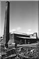
Cruden Bay Brickworks
Was home to a Marshall stationary steam engine - now removed.
Image: © Chris Allen
Taken: 7 May 1982
0.10 miles
2
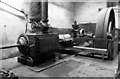
Cruden Bay Brickworks, steam engine
A Marshall horizontal single cylinder engine at this now demolished works - Image It was built in 1903 and stopped 1974/5. It has been removed and is believed to survive. It is of about 150 horsepower and has expansion slide valves. The flywheel is 12' diameter.
Image: © Chris Allen
Taken: 7 May 1982
0.10 miles
4
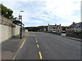
Bus stop and shelter on Errollston Road (A975), Cruden Bay
Image: © JThomas
Taken: 21 Aug 2020
0.18 miles
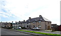
6
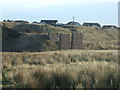
Remains of Rail Viaduct from Cruden Bay
Image: © Ken Fitlike
Taken: 30 Jan 2007
0.21 miles
7
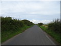
Minor road near Errolston
Towards Auchiries.
Image: © JThomas
Taken: 21 Aug 2020
0.23 miles
8
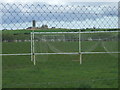
Watson Park, Cruden Bay
Home Cruden Bay Junior Football Club.
(adjacent gridsquares)
Also in shot are Slains Lodge NK0936(spooky disused farm steading) and the topmost remains of Slains Castle NK1036 on the cliff edge
Image: © Ken Fitlike
Taken: 15 May 2007
0.24 miles