IMAGES TAKEN NEAR TO
Kirklands, ELLON, AB41 7DZ

Introduction

This page details the photographs taken nearby to Kirklands, AB41 7DZ by members of the Geograph project.

The Geograph project started in 2005 with the aim of publishing, organising and preserving representative images for every square kilometre of Great Britain, Ireland and the Isle of Man.

There are currently over 7.5m images from over14,400 individuals and you can help contribute to the project by visiting https://www.geograph.org.uk

Image Map


Images are licensed for reuse under creativecommons.org/licenses/by-sa/2.0
Notes
  • Clicking on the map will re-center to the selected point.
  • The higher the marker number, the further away the image location is from the centre of the postcode.

Image Listing (37 Images Found)

Images are licensed for reuse under creativecommons.org/licenses/by-sa/2.0
  • ...
Image
Details
Distance
1
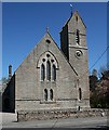
New Parish Kirk
Designed by Thomas Brown and James Maitland Wardrop and built in 1865-1867, this pointed Gothic kirk replaced Image An apse was added in 1908.
Image: © Anne Burgess Taken: 14 May 2009
0.08 miles
2
Methlick Kirk
A view of the rear of Methlick's parish church.
Image: © Andrew Wood Taken: 13 Aug 2020
0.08 miles
3
Methlick Parish Church
Image: © Derek Gray Taken: 6 Mar 2009
0.08 miles
4
Old milestone
This is one of 3 stones found on the 5 mile route between Haddo House and Gight Castle, now a ruin. It is in Methlick on the pavement opposite the church. HH can be seen on the bevel.
Image: © Chris McBrien Taken: 17 Oct 2019
0.09 miles
5
Methlick new kirk
The new (and present) Parish Kirk dating from 1865 and B-listed: http://portal.historic-scotland.gov.uk/designation/LB16462 . The rather unusual T-shape was apparently to accommodate the Laird's gallery (the Earl of Aberdeen).
Image: © Bill Harrison Taken: 2 Apr 2016
0.10 miles
6
Auld and New Kirk
From the Ythan a view of the new church on the left and the gable of the ruined old church on the right.
Image: © Andrew Wood Taken: 13 Aug 2020
0.11 miles
7
Two Trees by Ythan
Two trees , one living and one dead, straddle the Ythan as it flows southerly by Methlick.
Image: © Andrew Wood Taken: 13 Aug 2020
0.11 miles
8
Sauchentree Foot Bridge
A small concrete food bridge carrying a path over the Burn of Sauchentree just as it joins the Ythan at Methlick.
Image: © Andrew Wood Taken: 13 Aug 2020
0.11 miles
9
Methlick War Memorial
A well-maintained memorial with the auld kirk and graveyard in the background.
Image: © Mary and Angus Hogg Taken: 22 Aug 2019
0.11 miles
10
Methlick scene
Methlick is a pleasant and peaceful small village in the Ythan valley about 11 km northeast of Ellon. Here we see the village nature walk with the war memorial and ruined old kirk in the background.
Image: © Bill Harrison Taken: 2 Apr 2016
0.12 miles
  • ...