IMAGES TAKEN NEAR TO
Foveran, ELLON, AB41 6AF
Introduction
This page details the photographs taken nearby to AB41 6AF by members of the Geograph project.
The Geograph project started in 2005 with the aim of publishing, organising and preserving representative images for every square kilometre of Great Britain, Ireland and the Isle of Man.

There are currently over 7.5m images from over14,400 individuals and you can help contribute to the project by visiting https://www.geograph.org.uk
Image Map
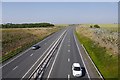
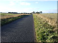
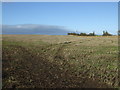
Images are licensed for reuse under creativecommons.org/licenses/by-sa/2.0
Notes
- Clicking on the map will re-center to the selected point.
- The higher the marker number, the further away the image location is from the centre of the postcode.
Image Listing (12 Images Found)
Images are licensed for reuse under creativecommons.org/licenses/by-sa/2.0
Image
Details
Distance
2
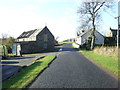
Ladeside Foveran
A farm conversion at Mill of Foveran.
Image: © Andrew Wood
Taken: 3 Jun 2009
0.03 miles
3
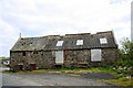
Mill of Foveran
The disused Mill buildings at Mill of Foveran.
Image: © Andrew Wood
Taken: 3 Jun 2009
0.04 miles
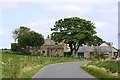
7
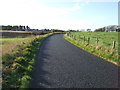
Country road heading west
Near Mill of Foveran.
Image: © JThomas
Taken: 10 Nov 2013
0.15 miles

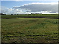
10
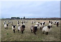
Foveran sheep
These sheep seemed keen to be photographed and ran to the gate...
Image: © Bill Harrison
Taken: 7 Mar 2020
0.20 miles