IMAGES TAKEN NEAR TO
Glenbervie, STONEHAVEN, AB39 3YR
Introduction
This page details the photographs taken nearby to AB39 3YR by members of the Geograph project.
The Geograph project started in 2005 with the aim of publishing, organising and preserving representative images for every square kilometre of Great Britain, Ireland and the Isle of Man.

There are currently over 7.5m images from over14,400 individuals and you can help contribute to the project by visiting https://www.geograph.org.uk
Image Map
Images are licensed for reuse under creativecommons.org/licenses/by-sa/2.0
Notes
- Clicking on the map will re-center to the selected point.
- The higher the marker number, the further away the image location is from the centre of the postcode.
Image Listing (13 Images Found)
Images are licensed for reuse under creativecommons.org/licenses/by-sa/2.0
Image
Details
Distance
5
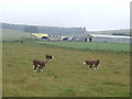
Hereford cattle at East Town Farm
A nice piece of steak or two on the hoof! The Brae of Glenbervie overlooks the scene.
Image: © Jonathan Billinger
Taken: 17 Jul 2007
0.10 miles
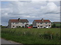
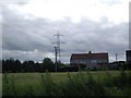
6
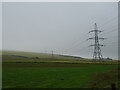
Grazing and power lines near East Town Farm
Image: © JThomas
Taken: 22 Jul 2021
0.11 miles
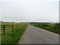
7
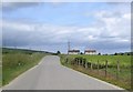
Road to Stonehaven
Approaching Hill View.
Image: © Stanley Howe
Taken: 8 Jul 2009
0.11 miles
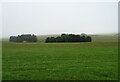
8
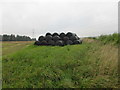
Wrapped bales
Wrapped bales to the east of Hillview Cottages.
Image: © Scott Cormie
Taken: 21 Sep 2019
0.12 miles
10
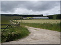
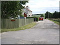
Access to East Town Farm
From near Hill View.
Image: © Stanley Howe
Taken: 8 Jul 2009
0.15 miles