IMAGES TAKEN NEAR TO
STONEHAVEN, AB39 3UY
Introduction
This page details the photographs taken nearby to AB39 3UY by members of the Geograph project.
The Geograph project started in 2005 with the aim of publishing, organising and preserving representative images for every square kilometre of Great Britain, Ireland and the Isle of Man.

There are currently over 7.5m images from over14,400 individuals and you can help contribute to the project by visiting https://www.geograph.org.uk
Image Map
Images are licensed for reuse under creativecommons.org/licenses/by-sa/2.0
Notes
- Clicking on the map will re-center to the selected point.
- The higher the marker number, the further away the image location is from the centre of the postcode.
Image Listing (6 Images Found)
Images are licensed for reuse under creativecommons.org/licenses/by-sa/2.0
Image
Details
Distance
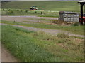
3
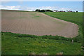
Tatties at Tannachie
Judging by the deep furrows, the bare field below Tannachie has been planted with tatties. Or has it?
Image: © Anne Burgess
Taken: 6 Jun 2013
0.03 miles
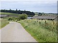
4
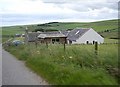
Cottage near Tannachie
The cottage stands part way up the slope above the River Carron.
Image: © Anne Burgess
Taken: 6 Jun 2013
0.03 miles
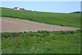
6
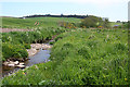
Site of Mill of Buckie
You might think, from the 1:25,000 map, that the mill shown on the riverbank here was Buckie's Mill, but you'd be wrong. There was a mill here, but it was called Mill of Buckie, and was quite separate from nearby Buckie's Mill. There is no longer any trace of it, but I was shown the site by a gentleman who had known it before it was demolished. He told me that the mill wheel overhung the River Carron; with the eye of faith, one might imagine that there is a groove in the bank which might have been a lade at one time long ago. The miller's house is a little way up the hill, very wisely, because the Carron has been known to flood.
Image: © Anne Burgess
Taken: 6 Jun 2013
0.25 miles