
IMAGES TAKEN NEAR TO
Rickarton, STONEHAVEN, AB39 3TD
Introduction
This page details the photographs taken nearby to AB39 3TD by members of the Geograph project.
The Geograph project started in 2005 with the aim of publishing, organising and preserving representative images for every square kilometre of Great Britain, Ireland and the Isle of Man.

There are currently over 7.5m images from over14,400 individuals and you can help contribute to the project by visiting https://www.geograph.org.uk
Image Map
Images are licensed for reuse under creativecommons.org/licenses/by-sa/2.0
Notes
- Clicking on the map will re-center to the selected point.
- The higher the marker number, the further away the image location is from the centre of the postcode.
Image Listing (10 Images Found)
Images are licensed for reuse under creativecommons.org/licenses/by-sa/2.0
Image
Details
Distance
1

Rickarton hamlet
On the Slug Road (A957) to Stonehaven. The first house on the right is a former church, now converted to a dwelling. On the churchyard wall in the foreground is a plaster plaque commemorating the dead of two World Wars from this erstwhile parish.
Image: © Stanley Howe
Taken: 6 Jun 2013
0.00 miles

3

Stonehaven Half Marathon at Rickarton
Image: © Douglas Nelson
Taken: 4 Jul 2010
0.02 miles
4

Telephone kiosk at Rickarton
In 2013; cf. Image] of 2008.
Image: © Stanley Howe
Taken: 6 Jun 2013
0.04 miles
5

Former church, Rickarton
Now a residence.
Image: © Stanley Howe
Taken: 29 Jun 2009
0.04 miles


9

Approaching Rickarton from the east
Double white lies on A957 (Slug Road). Glenton Croft is the first building on the left of the main road through the village.
Image: © Stanley Howe
Taken: 12 Nov 2017
0.18 miles
10
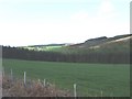
View north towards Rickarton
From near nether Swanley.
Image: © Stanley Howe
Taken: 19 May 2008
0.23 miles