IMAGES TAKEN NEAR TO
Netherley, STONEHAVEN, AB39 3QQ
Introduction
This page details the photographs taken nearby to AB39 3QQ by members of the Geograph project.
The Geograph project started in 2005 with the aim of publishing, organising and preserving representative images for every square kilometre of Great Britain, Ireland and the Isle of Man.

There are currently over 7.5m images from over14,400 individuals and you can help contribute to the project by visiting https://www.geograph.org.uk
Image Map
Images are licensed for reuse under creativecommons.org/licenses/by-sa/2.0
Notes
- Clicking on the map will re-center to the selected point.
- The higher the marker number, the further away the image location is from the centre of the postcode.
Image Listing (5 Images Found)
Images are licensed for reuse under creativecommons.org/licenses/by-sa/2.0
Image
Details
Distance
2
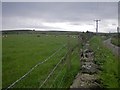
Cows grazing and lying in the level fields
Image: © C Michael Hogan
Taken: 6 Jul 2012
0.06 miles
3
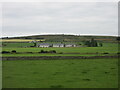
Nether Burnhaugh
Looking southwards to new builds at Nether Burnhaugh.
Image: © Scott Cormie
Taken: 30 Jul 2021
0.19 miles
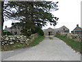
5
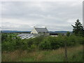
Upper Burnhaugh
Converted steading at Upper Burnhaugh.
Image: © Scott Cormie
Taken: 30 Jul 2021
0.24 miles