IMAGES TAKEN NEAR TO
STONEHAVEN, AB39 2TS
Introduction
This page details the photographs taken nearby to AB39 2TS by members of the Geograph project.
The Geograph project started in 2005 with the aim of publishing, organising and preserving representative images for every square kilometre of Great Britain, Ireland and the Isle of Man.

There are currently over 7.5m images from over14,400 individuals and you can help contribute to the project by visiting https://www.geograph.org.uk
Image Map
Images are licensed for reuse under creativecommons.org/licenses/by-sa/2.0
Notes
- Clicking on the map will re-center to the selected point.
- The higher the marker number, the further away the image location is from the centre of the postcode.
Image Listing (10 Images Found)
Images are licensed for reuse under creativecommons.org/licenses/by-sa/2.0
Image
Details
Distance
2
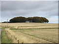
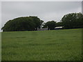
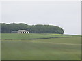
Law of Lumgair
The wooded Law of Lumgair and the farm of the same name in the centre of the picture.
Image: © Scott Cormie
Taken: 4 Oct 2018
0.02 miles
6
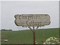
Rustic sign for Chapelton Cottage
In cattle-grazing countryside.
Image: © Stanley Howe
Taken: 25 Jun 2009
0.21 miles
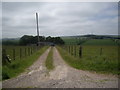
8
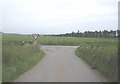
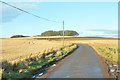
Approach to a road junction
By Law of Lumgair.
Image: © Stanley Howe
Taken: 25 Jun 2009
0.21 miles
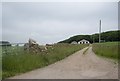
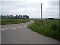
9
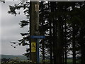
Sign for Crossgates
Supported by a convenient telegraph pole.
Image: © Stanley Howe
Taken: 25 Jun 2009
0.24 miles