IMAGES TAKEN NEAR TO
Queens Gardens, STONEHAVEN, AB39 2GR
Introduction
This page details the photographs taken nearby to Queens Gardens, AB39 2GR by members of the Geograph project.
The Geograph project started in 2005 with the aim of publishing, organising and preserving representative images for every square kilometre of Great Britain, Ireland and the Isle of Man.

There are currently over 7.5m images from over14,400 individuals and you can help contribute to the project by visiting https://www.geograph.org.uk
Image Map
Images are licensed for reuse under creativecommons.org/licenses/by-sa/2.0
Notes
- Clicking on the map will re-center to the selected point.
- The higher the marker number, the further away the image location is from the centre of the postcode.
Image Listing (21 Images Found)
Images are licensed for reuse under creativecommons.org/licenses/by-sa/2.0
Image
Details
Distance
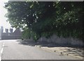
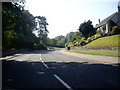
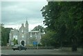
1
Manse Hill Avenue, Stonehaven
At junction with A957 Slug Road.
Image: © Stanley Howe
Taken: 2 Jul 2009
0.16 miles
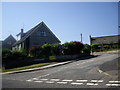
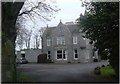
2
Princess Road, Stonehaven
At junction with A957 Slug Road.
Image: © Stanley Howe
Taken: 2 Jul 2009
0.16 miles
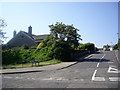
5
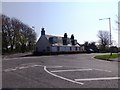
Cottage(s) on the Slug Road (A957) in Stonehaven
At the junction with Bath Street (forward left).
Image: © Stanley Howe
Taken: 28 Apr 2014
0.19 miles
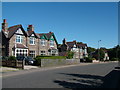
6
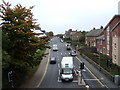
Arduthie Road
From the up-platform at Stonehaven Station.
Image: © Stanley Howe
Taken: 12 Oct 2007
0.20 miles
9
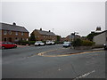
Stonehaven - Arduthie Road Junction with Station Road
Image: © James Emmans
Taken: 15 Sep 2016
0.22 miles