IMAGES TAKEN NEAR TO
Hamewith Avenue, STONEHAVEN, AB39 2GN
Introduction
This page details the photographs taken nearby to Hamewith Avenue, AB39 2GN by members of the Geograph project.
The Geograph project started in 2005 with the aim of publishing, organising and preserving representative images for every square kilometre of Great Britain, Ireland and the Isle of Man.

There are currently over 7.5m images from over14,400 individuals and you can help contribute to the project by visiting https://www.geograph.org.uk
Image Map
Images are licensed for reuse under creativecommons.org/licenses/by-sa/2.0
Notes
- Clicking on the map will re-center to the selected point.
- The higher the marker number, the further away the image location is from the centre of the postcode.
Image Listing (22 Images Found)
Images are licensed for reuse under creativecommons.org/licenses/by-sa/2.0
Image
Details
Distance
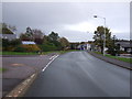
5
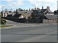
T Junction
The T Junction of Woodcot Lane with Woodcot Brae. The low building on the right of the photo the one with the wall mergeing into the actual wall was the mortuary for the Woodcot Hospital which is the taller building behind. The hospital has since been converted into flats, on 3 storeys. It was originally built in 1867 as a poorhouse
Image: © Liz Gray
Taken: 21 Apr 2010
0.16 miles
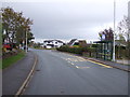
7
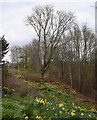
Memorial tree
Tree planted beside Dunnottar kirk in 1919 to commemorate the fallen in WWI and now reaching its centenary. The adjacent electricity tower doesn't add to the ambience.
Image: © Bill Harrison
Taken: 13 Apr 2019
0.17 miles
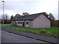
8
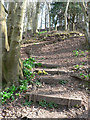
Wooden faced steps
Wooden faced steps with deciduous leaves covering all the treads
These steps take you from the woodland at the Carron Water to the road leading to Dunnottar Church cross the road and you are into the main part of Dunnottar Woods
Image: © Liz Gray
Taken: 14 Apr 2010
0.18 miles
9
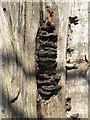
Tree fungus
Fungus growth on a half dead tree
Image: © Liz Gray
Taken: 12 Apr 2010
0.18 miles
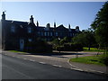
10
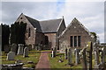
Dunnottar parish kirk and the Marischal aisle
The B-listed (LB2914) kirk dates from 1782 (http://portal.historicenvironment.scot/designation/LB2914 ) and the Marischal aisle to the right was erected in 1582 but heavily restored in 1913; also B-listed (LB2915): http://portal.historicenvironment.scot/designation/LB2915 .
Image: © Bill Harrison
Taken: 13 Apr 2019
0.19 miles