IMAGES TAKEN NEAR TO
Dinnet, ABOYNE, AB34 5PP
Introduction
This page details the photographs taken nearby to AB34 5PP by members of the Geograph project.
The Geograph project started in 2005 with the aim of publishing, organising and preserving representative images for every square kilometre of Great Britain, Ireland and the Isle of Man.

There are currently over 7.5m images from over14,400 individuals and you can help contribute to the project by visiting https://www.geograph.org.uk
Image Map
Images are licensed for reuse under creativecommons.org/licenses/by-sa/2.0
Notes
- Clicking on the map will re-center to the selected point.
- The higher the marker number, the further away the image location is from the centre of the postcode.
Image Listing (31 Images Found)
Images are licensed for reuse under creativecommons.org/licenses/by-sa/2.0
Image
Details
Distance
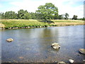
1
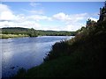
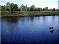
Downstream River Dee
From close to Fasnadarach.
Image: © Stanley Howe
Taken: 14 Aug 2013
0.04 miles
2
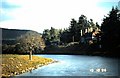
Fasnadarroch by the Dee
From Dinnet Bridge.
Image: © Stanley Howe
Taken: 10 Oct 1986
0.05 miles
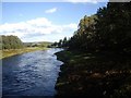
3
A bend in the Dee
At Fasnarach; seen from near the Sandy Bay bothy.
Image: © Stanley Howe
Taken: 15 Aug 2013
0.07 miles
4
Fasnadarach; by the Dee
Viewed downstream, along the river bank.
Image: © Stanley Howe
Taken: 15 Aug 2013
0.08 miles
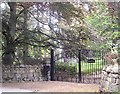
7
River-bank steps, up to Fasnadarah
From The River Dee.
Image: © Stanley Howe
Taken: 15 Aug 2013
0.09 miles
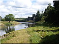
8
Fasnadarroch
Viewed downstream River Dee from the Dinnet Bridge
Image: © Stanley Howe
Taken: 5 Oct 2010
0.09 miles
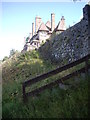
9
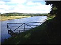
Riverside boundary fence
Fasnadarach waterfront.
Image: © Stanley Howe
Taken: 15 Aug 2013
0.10 miles
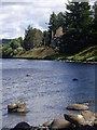
10
A river-bank tree, opposite Fasnadarach
Reflected in the rippled surface of the River Dee.
Image: © Stanley Howe
Taken: 15 Aug 2013
0.10 miles