
IMAGES TAKEN NEAR TO
Tarland, ABOYNE, AB34 4UR
Introduction
This page details the photographs taken nearby to AB34 4UR by members of the Geograph project.
The Geograph project started in 2005 with the aim of publishing, organising and preserving representative images for every square kilometre of Great Britain, Ireland and the Isle of Man.

There are currently over 7.5m images from over14,400 individuals and you can help contribute to the project by visiting https://www.geograph.org.uk
Image Map
Images are licensed for reuse under creativecommons.org/licenses/by-sa/2.0
Notes
- Clicking on the map will re-center to the selected point.
- The higher the marker number, the further away the image location is from the centre of the postcode.
Image Listing (6 Images Found)
Images are licensed for reuse under creativecommons.org/licenses/by-sa/2.0
Image
Details
Distance
1
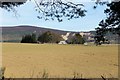
Melgum farm
Sitting in open country with Pressendye behind, Melgum Farm has its own little shelter belt of trees.
Image: © Andrew Wood
Taken: 8 Apr 2017
0.04 miles
2
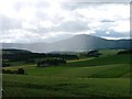
Melgum and Cot Hill
View south west from unclassified road above Oldmill (NJ482067) towards the farm Melgum with Cot Hill tipped by the plantation on the right. In the distance behind the passing rain shower is Morven at 872m high.
Image: © Mick Garratt
Taken: 3 Aug 2005
0.13 miles
3
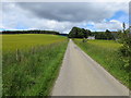
Minor road approaching Melgum
Looking north-eastward.
Image: © Peter Wood
Taken: 10 Jul 2020
0.13 miles
4
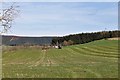
Rolling by Winds'ee
A tractor rolling grass by Wind'ee the roof of which is just visible. The woodland at the right is on Cot Hill.
Image: © Andrew Wood
Taken: 8 Apr 2017
0.17 miles
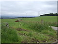
6
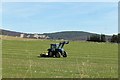
End of the Run
Grass rolling by Melgum and the last run of the morning.
Image: © Andrew Wood
Taken: 8 Apr 2017
0.24 miles