IMAGES TAKEN NEAR TO
Craigievar, ALFORD, AB33 8JR
Introduction
This page details the photographs taken nearby to AB33 8JR by members of the Geograph project.
The Geograph project started in 2005 with the aim of publishing, organising and preserving representative images for every square kilometre of Great Britain, Ireland and the Isle of Man.

There are currently over 7.5m images from over14,400 individuals and you can help contribute to the project by visiting https://www.geograph.org.uk
Image Map
Images are licensed for reuse under creativecommons.org/licenses/by-sa/2.0
Notes
- Clicking on the map will re-center to the selected point.
- The higher the marker number, the further away the image location is from the centre of the postcode.
Image Listing (11 Images Found)
Images are licensed for reuse under creativecommons.org/licenses/by-sa/2.0
Image
Details
Distance
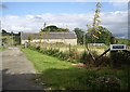
1
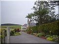
Bridgealehouse and garden
Access from the minor road.
Image: © Stanley Howe
Taken: 30 Jul 2012
0.01 miles
2
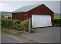
Garage at Brigalehouse
Note resident's preferred anglicized spelling 'Bridgeale House' on the plaque.
Image: © Stanley Howe
Taken: 30 Jul 2012
0.02 miles
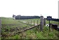
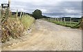
3
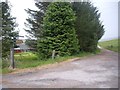
Junction for Wester Leochel
From the minor road by Brigalehouse.
Image: © Stanley Howe
Taken: 30 Jul 2012
0.03 miles
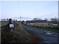
4
Access to Wester Leochel
From near Brigalehouse.
Image: © Stanley Howe
Taken: 25 Aug 2010
0.07 miles
5
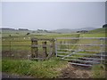
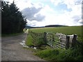
Field boundaries near Brigalehouse
Steel gates and wire fence.
Image: © Stanley Howe
Taken: 30 Jul 2012
0.09 miles
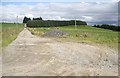
6
Access to Upper Leochel
From O'Neil Corse minor road.
Image: © Stanley Howe
Taken: 30 Jul 2012
0.10 miles
9
Hillocks steading
New sign since Dec'2007 Image] has promoted the 'Hillock' of OS Landranger map to 'Hillocks'. A case of going forth to multiply? Or just recent orogeny?
Image: © Stanley Howe
Taken: 25 Aug 2010
0.14 miles
10
Access to Kirkton Cottage
From the road south to Corse O'Neil.
Image: © Stanley Howe
Taken: 25 Aug 2010
0.18 miles