
IMAGES TAKEN NEAR TO
Whitehouse, ALFORD, AB33 8DJ
Introduction
This page details the photographs taken nearby to AB33 8DJ by members of the Geograph project.
The Geograph project started in 2005 with the aim of publishing, organising and preserving representative images for every square kilometre of Great Britain, Ireland and the Isle of Man.

There are currently over 7.5m images from over14,400 individuals and you can help contribute to the project by visiting https://www.geograph.org.uk
Image Map
Images are licensed for reuse under creativecommons.org/licenses/by-sa/2.0
Notes
- Clicking on the map will re-center to the selected point.
- The higher the marker number, the further away the image location is from the centre of the postcode.
Image Listing (14 Images Found)
Images are licensed for reuse under creativecommons.org/licenses/by-sa/2.0
Image
Details
Distance
1

Barley, Whitehouse
View across arable land towards Benquhallie.
Image: © Richard Webb
Taken: 17 Sep 2016
0.03 miles
2
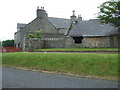
A house with steading
The one in better nick than the other. By the old railway station in Whitehouse.
Image: © Stanley Howe
Taken: 17 Jul 2008
0.03 miles
3

Stubble, Whitehouse
Straw awaits baling with a hot air balloon landing near Alford.
Image: © Richard Webb
Taken: 17 Sep 2016
0.05 miles
4
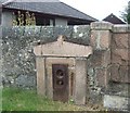
A Victorian water tap at Whitehouse
Patented in Kilmarnock - probably then by Shanks? It stands beside a cattle trough that commemorated the Queen's Diamond Jubilee in 1897.
Image: © Stanley Howe
Taken: 17 Jul 2008
0.07 miles
5
The west abutment
Of the old railway bridge at Whitehouse Station.
Image: © Stanley Howe
Taken: 17 Jul 2008
0.07 miles
6
The east abutment
Of the old railway bridge at Whitehouse Station.
Image: © Stanley Howe
Taken: 17 Jul 2008
0.07 miles
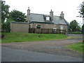
8

House at Whitehouse
At junction with Insch road
Image: © Stanley Howe
Taken: 13 Jul 2006
0.07 miles
9

Road sign
At junction of B992 with the A944 at Whitehouse.
Image: © Stanley Howe
Taken: 17 Jul 2008
0.07 miles
10
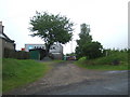
Former station yard
The crane and containers suggest a present day connection to road transport.
Image: © Stanley Howe
Taken: 17 Jul 2008
0.07 miles