
IMAGES TAKEN NEAR TO
Dunecht, WESTHILL, AB32 7EJ
Introduction
This page details the photographs taken nearby to AB32 7EJ by members of the Geograph project.
The Geograph project started in 2005 with the aim of publishing, organising and preserving representative images for every square kilometre of Great Britain, Ireland and the Isle of Man.

There are currently over 7.5m images from over14,400 individuals and you can help contribute to the project by visiting https://www.geograph.org.uk
Image Map
Images are licensed for reuse under creativecommons.org/licenses/by-sa/2.0
Notes
- Clicking on the map will re-center to the selected point.
- The higher the marker number, the further away the image location is from the centre of the postcode.
Image Listing (27 Images Found)
Images are licensed for reuse under creativecommons.org/licenses/by-sa/2.0
Image
Details
Distance
1
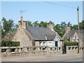
Cottage, Dunecht
A minuscule cottage facing onto the A944. Note the unusual wall.
Image: © Bill Harrison
Taken: 23 Aug 2015
0.01 miles
2
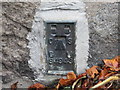
Ordnance Survey Flush Bracket G4943
This bracket can be found on the roadside wall of a private dwelling at Bridgend, Dunecht. The benchmark's recorded height is 98.557 metres above sea level.
For more detail see : https://www.bench-marks.org.uk/bm547
Image: © Peter Wood
Taken: 16 Oct 2019
0.01 miles
3
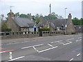
Bridgend, Dunecht
The east end of the village, close to where the A944 Alford road crosses the Corskie Burn.
Image: © Colin Smith
Taken: 1 Aug 2011
0.02 miles
4
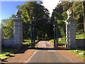
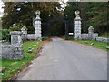
Dunecht Estate Gateway
Gateway to Dunecht Estate from Dunecht village.
Image: © David Robinson
Taken: 18 Jun 2017
0.03 miles
5
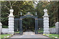
Gateway to Dunecht House
B-listed from ca. 1924: http://data.historic-scotland.gov.uk/pls/htmldb/f?p=2200:15:0::::BUILDING:3130 . Note the heraldic griffins on top of the gate piers.
Image: © Bill Harrison
Taken: 23 Aug 2015
0.04 miles
7
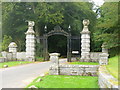
Gateway at Dunecht
Ornate stone gateway with wrought iron arch, Dunecht. The driveway leads, through extensive grounds, to Dunecht House.
http://www.dunechtestates.co.uk/
Image: © Colin Smith
Taken: 1 Aug 2011
0.05 miles
9
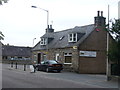
Jaff's, Dunecht
Village bar and restaurant at Dunecht, on the Alford Road west of Aberdeen.
Image: © Colin Smith
Taken: 1 Aug 2011
0.06 miles
10
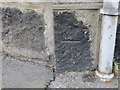
Ordnance Survey Cut Mark
This mark can be found on the roadside wall of a private dwelling (former Post Office) in Dunecht. The benchmark's recorded height is 100.85 metres above sea level.
For more detail see : https://www.bench-marks.org.uk/bm112859
Image: © Peter Wood
Taken: 16 Oct 2019
0.07 miles