
IMAGES TAKEN NEAR TO
Skene, WESTHILL, AB32 6UX
Introduction
This page details the photographs taken nearby to AB32 6UX by members of the Geograph project.
The Geograph project started in 2005 with the aim of publishing, organising and preserving representative images for every square kilometre of Great Britain, Ireland and the Isle of Man.

There are currently over 7.5m images from over14,400 individuals and you can help contribute to the project by visiting https://www.geograph.org.uk
Image Map
Images are licensed for reuse under creativecommons.org/licenses/by-sa/2.0
Notes
- Clicking on the map will re-center to the selected point.
- The higher the marker number, the further away the image location is from the centre of the postcode.
Image Listing (37 Images Found)
Images are licensed for reuse under creativecommons.org/licenses/by-sa/2.0
Image
Details
Distance
1
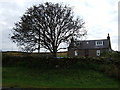
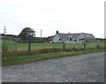
A cottage at Redhill
With a rowan at the front door; a shield from witches hereabouts in days of yore.
Image: © Stanley Howe
Taken: 10 Oct 2007
0.03 miles
3
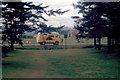
Echt, Aberdeenshire - 1987
Echt is an Aberdeenshire crossroads village in northeast Scotland.
Echt has a number of prehistoric remains, including the so called Barmekin of Echt which is on a hill to the northwest.
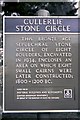
There is also the Cullerlie stone circle near Sunhoney Farm, which may date from the Bronze Age.
Image: © Helmut Zozmann
Taken: Unknown
0.12 miles
4
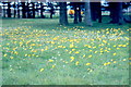
Echt, Aberdeenshire - 1987
Echt is an Aberdeenshire crossroads village in northeast Scotland.
Echt has a number of prehistoric remains, including the so called Barmekin of Echt which is on a hill to the northwest.
There is also the Cullerlie stone circle near Sunhoney Farm, which may date from the Bronze Age.
Image: © Helmut Zozmann
Taken: Unknown
0.13 miles
5
Echt, Aberdeenshire - 1987
Echt is an Aberdeenshire crossroads village in northeast Scotland.
Echt has a number of prehistoric remains, including the so called Barmekin of Echt which is on a hill to the northwest.
There is also the Cullerlie stone circle near Sunhoney Farm, which may date from the Bronze Age.
Image: © Helmut Zozmann
Taken: Unknown
0.15 miles
7
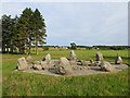
Cullerlie stone circle
A substantial stone circle made of granite boulders. It has been excavated and a lot of previous buried features are exposed. It is easy to visit being a short walk from parking.
Image: © Richard Webb
Taken: 14 Jul 2013
0.21 miles
8
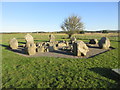
Cullerlie Stone Circle
The Historic Scotland cared for Cullerlie Stone Circle.
Image: © Scott Cormie
Taken: 26 Oct 2019
0.21 miles
9
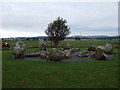
Cullerlie stone circle
See http://www.aberdeenshire.gov.uk/archaeology/sites/stonecircles/cullerie.asp
Image: © Stanley Howe
Taken: 10 Oct 2007
0.21 miles
10
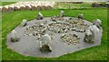
Cullerlie stone circle
Stone circle surrounding eight small kerbed cairns. The site was excavated in 1935. https://canmore.org.uk/site/18548/cullerlie
Image: © Sandy Gerrard
Taken: 14 Sep 2014
0.21 miles