IMAGES TAKEN NEAR TO
Tocher Lane, BANCHORY, AB31 5RZ
Introduction
This page details the photographs taken nearby to Tocher Lane, AB31 5RZ by members of the Geograph project.
The Geograph project started in 2005 with the aim of publishing, organising and preserving representative images for every square kilometre of Great Britain, Ireland and the Isle of Man.

There are currently over 7.5m images from over14,400 individuals and you can help contribute to the project by visiting https://www.geograph.org.uk
Image Map
Images are licensed for reuse under creativecommons.org/licenses/by-sa/2.0
Notes
- Clicking on the map will re-center to the selected point.
- The higher the marker number, the further away the image location is from the centre of the postcode.
Image Listing (35 Images Found)
Images are licensed for reuse under creativecommons.org/licenses/by-sa/2.0
Image
Details
Distance
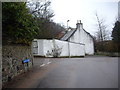
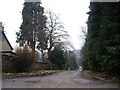
1
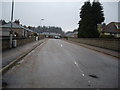
Burnett Terrace
Off Burnett Road, Banchory.
Image: © Stanley Howe
Taken: 6 Feb 2010
0.10 miles
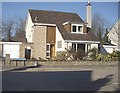
2
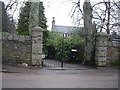
Gateway to Rosewood
Burnett Road, Banchory.
Image: © Stanley Howe
Taken: 6 Feb 2010
0.15 miles
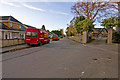
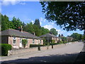
4
Burnett Terrace, leading to Burnett Hill
From Burnett Road, Banchory.
Image: © Stanley Howe
Taken: 1 Mar 2011
0.15 miles
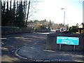
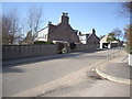
5
East end of Burnett Road
At its junction with Mount Street, Banchory.
Image: © Stanley Howe
Taken: 6 Feb 2010
0.16 miles
6
Junction of Rosehill Lane with Mount Street
Banchory.
Image: © Stanley Howe
Taken: 1 Mar 2011
0.17 miles
8
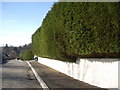
A bumper garden hedge
In Rosehill Lane, Banchory.
Image: © Stanley Howe
Taken: 1 Mar 2011
0.18 miles
9
Top end of Corsee Hill
From junction with Burnett Road.
Image: © Stanley Howe
Taken: 6 Feb 2010
0.18 miles
10
Junction of Lawson Avenue with Hillcroft Road
Image: © Stanley Howe
Taken: 1 Mar 2011
0.18 miles