IMAGES TAKEN NEAR TO
Crathes, BANCHORY, AB31 5QQ
Introduction
This page details the photographs taken nearby to AB31 5QQ by members of the Geograph project.
The Geograph project started in 2005 with the aim of publishing, organising and preserving representative images for every square kilometre of Great Britain, Ireland and the Isle of Man.

There are currently over 7.5m images from over14,400 individuals and you can help contribute to the project by visiting https://www.geograph.org.uk
Image Map
Images are licensed for reuse under creativecommons.org/licenses/by-sa/2.0
Notes
- Clicking on the map will re-center to the selected point.
- The higher the marker number, the further away the image location is from the centre of the postcode.
Image Listing (29 Images Found)
Images are licensed for reuse under creativecommons.org/licenses/by-sa/2.0
Image
Details
Distance
1
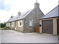
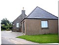
Little Minklets cottage
With double garage.
Image: © Stanley Howe
Taken: 31 Jul 2013
0.00 miles
2
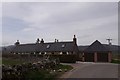
Little Minklets
With Ashdown at left rear.
Image: © Stanley Howe
Taken: 19 Mar 2014
0.01 miles
3
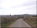
Approach to Little Minklets from the south
And Ashdown, far left.
Image: © Stanley Howe
Taken: 19 Mar 2014
0.01 miles
4
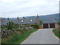
Little Minklets corner
On The Neuk to Hirn road.
Image: © Stanley Howe
Taken: 4 May 2007
0.01 miles
5
Little Minklets corner
On minor road to join A93 at The Neuk.
Image: © Stanley Howe
Taken: 31 Jul 2013
0.01 miles
6
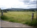
A field of barley near Little Minklets
Access from the minor road between Minklets and Little Minklets.
Image: © Stanley Howe
Taken: 31 Jul 2013
0.08 miles
7
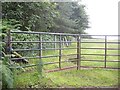
Wind break near Little Minklets
Looking west from the minor road, through a double 6-bar steel gate.
Image: © Stanley Howe
Taken: 31 Jul 2013
0.10 miles
8
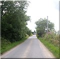
Approach to Little Minklets
Along the minor road from Minklets Farm.
Image: © Stanley Howe
Taken: 31 Jul 2013
0.10 miles
9
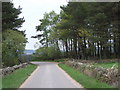
Tree belt
Across the road from The Neuk to Minklets.
Image: © Stanley Howe
Taken: 4 May 2007
0.10 miles
10
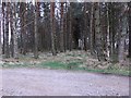
Shelter belt near Minklets
Narrow but dense stand of pines, with some signs of a track through it (not mapped).
Image: © Stanley Howe
Taken: 19 Mar 2014
0.11 miles