
IMAGES TAKEN NEAR TO
Drumoak, BANCHORY, AB31 5AS
Introduction
This page details the photographs taken nearby to AB31 5AS by members of the Geograph project.
The Geograph project started in 2005 with the aim of publishing, organising and preserving representative images for every square kilometre of Great Britain, Ireland and the Isle of Man.

There are currently over 7.5m images from over14,400 individuals and you can help contribute to the project by visiting https://www.geograph.org.uk
Image Map
Images are licensed for reuse under creativecommons.org/licenses/by-sa/2.0
Notes
- Clicking on the map will re-center to the selected point.
- The higher the marker number, the further away the image location is from the centre of the postcode.
Image Listing (13 Images Found)
Images are licensed for reuse under creativecommons.org/licenses/by-sa/2.0
Image
Details
Distance
1

Cairnton Wood
A lovely piece of mossy stonework.
Image: © Richard Webb
Taken: 4 Apr 2017
0.06 miles
2

Road near Cairnton
Cairnton Wood to the left.
Image: © Alan Findlay
Taken: 29 Oct 2009
0.07 miles
3

Edge of Cairnton Wood
A view over to the Kincardineshire side of the Dee.
Image: © Richard Webb
Taken: 4 Apr 2017
0.07 miles


6
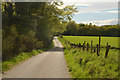
The Deeside Way near Coalford, Aberdeenshire
View facing west along part of the route of the Deeside Way long distance trail in Aberdeenshire. This part of the route follows a public road.
Image: © Andrew Tryon
Taken: 12 May 2019
0.13 miles
7

Field of turnips
Corner of turnip field, with Old Manse Wood beyond.
Image: © Scott Cormie
Taken: 26 Oct 2019
0.18 miles
8

West Cairnton
Road leading to West Cairnton converted farm
Image: © Alan Findlay
Taken: 17 Aug 2007
0.19 miles
9
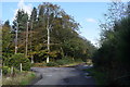
Country junction
The minor road makes a 90-degree bend and meets two private farm roads.
Image: © Bill Harrison
Taken: 19 Oct 2019
0.21 miles
10

Road from Drum towards Moss-side
Near Bogton Farm access.
Image: © Stanley Howe
Taken: 4 Oct 2007
0.21 miles