
IMAGES TAKEN NEAR TO
Lumphanan, BANCHORY, AB31 4RH
Introduction
This page details the photographs taken nearby to AB31 4RH by members of the Geograph project.
The Geograph project started in 2005 with the aim of publishing, organising and preserving representative images for every square kilometre of Great Britain, Ireland and the Isle of Man.

There are currently over 7.5m images from over14,400 individuals and you can help contribute to the project by visiting https://www.geograph.org.uk
Image Map
Images are licensed for reuse under creativecommons.org/licenses/by-sa/2.0
Notes
- Clicking on the map will re-center to the selected point.
- The higher the marker number, the further away the image location is from the centre of the postcode.
Image Listing (19 Images Found)
Images are licensed for reuse under creativecommons.org/licenses/by-sa/2.0
Image
Details
Distance
2
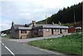
Crossroads Hotel
Once a simple pub (PH on OS maps), it now proclaims itself a hotel with en suite accommodation.
Image: © Stanley Howe
Taken: 24 Apr 2007
0.06 miles
3
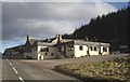
Crossroads Hotel
Public house on B9119.
Image: © Stanley Howe
Taken: 25 Feb 2011
0.06 miles
4
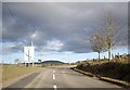
Approach to staggered crossroada
Along B9119 from Tarland.
Image: © Stanley Howe
Taken: 25 Feb 2011
0.06 miles
5
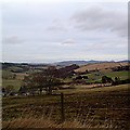
View from Crossroad Inn
Over Craigievar towards Alford. Bennachie can just be seen in the far right distance.
Image: © Stanley Howe
Taken: 17 Jan 2006
0.06 miles
6
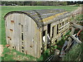
Derelict railway-carriage at Crossroads
Now even beyond its sell-by date as a 'henhoose'.
Image: © Stanley Howe
Taken: 24 Apr 2007
0.07 miles
7
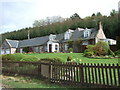
Greystone Corse
Converted steading on B9119 by Crossroads.
Image: © Stanley Howe
Taken: 24 Apr 2007
0.09 miles
9
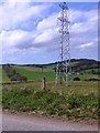
Electricity grid pylon near Crossroads
Viewed north from the B9119.
Image: © Stanley Howe
Taken: 2 May 2014
0.10 miles
10
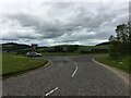
Junction of the A980 and B9119 roads
Unusually the A road gives way to the B road.
Image: © Steven Brown
Taken: 14 Jun 2022
0.13 miles