
IMAGES TAKEN NEAR TO
BANCHORY, AB31 4EQ
Introduction
This page details the photographs taken nearby to AB31 4EQ by members of the Geograph project.
The Geograph project started in 2005 with the aim of publishing, organising and preserving representative images for every square kilometre of Great Britain, Ireland and the Isle of Man.

There are currently over 7.5m images from over14,400 individuals and you can help contribute to the project by visiting https://www.geograph.org.uk
Image Map
Images are licensed for reuse under creativecommons.org/licenses/by-sa/2.0
Notes
- Clicking on the map will re-center to the selected point.
- The higher the marker number, the further away the image location is from the centre of the postcode.
Image Listing (32 Images Found)
Images are licensed for reuse under creativecommons.org/licenses/by-sa/2.0
Image
Details
Distance
1

Upper Lochton housing
From the access road to the Crow's Nest recycling plant.
Image: © Stanley Howe
Taken: 28 Oct 2011
0.01 miles

3

A junior football pitch
Upper Lochton.
Image: © Stanley Howe
Taken: 25 Sep 2007
0.04 miles


6
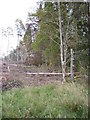
Clear felling
In a wood near Upper Lochton.
Image: © Stanley Howe
Taken: 26 Sep 2007
0.13 miles
7

Lochton Croft
Junction of A980 with the access road to Upper Lochton.
Image: © Stanley Howe
Taken: 28 Oct 2011
0.16 miles
8
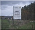
More development on the outskirts of Banchory
But what is in a name? The notice board is on the Upper Lochton Wood side of the A980 out of Banchory; the Wood of Arbedie ends where the trees on the right meet the main road.
Image: © Stanley Howe
Taken: 28 Oct 2011
0.16 miles
9

The A980 from a gravel pullout
Photographer is standing on the gravel pullout looking generally northward.
Image: © C Michael Hogan
Taken: 7 Jul 2013
0.17 miles
10

Forest clearing
For telephone lines, Upper Lochton.
Image: © Stanley Howe
Taken: 25 Sep 2007
0.17 miles