
IMAGES TAKEN NEAR TO
West Burnside, LAURENCEKIRK, AB30 1UY
Introduction
This page details the photographs taken nearby to West Burnside, AB30 1UY by members of the Geograph project.
The Geograph project started in 2005 with the aim of publishing, organising and preserving representative images for every square kilometre of Great Britain, Ireland and the Isle of Man.

There are currently over 7.5m images from over14,400 individuals and you can help contribute to the project by visiting https://www.geograph.org.uk
Image Map
Images are licensed for reuse under creativecommons.org/licenses/by-sa/2.0
Notes
- Clicking on the map will re-center to the selected point.
- The higher the marker number, the further away the image location is from the centre of the postcode.
Image Listing (32 Images Found)
Images are licensed for reuse under creativecommons.org/licenses/by-sa/2.0
Image
Details
Distance
1
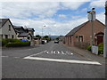
Gardenston St, Laurencekirk
From its junction with the High Street (A937). The 'No through way' is because there is a secured railway level crossing ahead.
Image: © Stanley Howe
Taken: 12 Jul 2017
0.08 miles
2
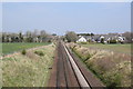
Looking down the line
The railway opened in 1849 as part of the Aberdeen Railway and is now the main line from Dundee to Aberdeen. The 'road sign' beside the track warns the driver of a 'station ahead'.
Image: © Bill Harrison
Taken: 21 Apr 2019
0.10 miles
3
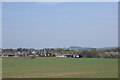
Looking towards Laurencekirk?
...with Tullo wind farm in the distance.
Image: © Bill Harrison
Taken: 21 Apr 2019
0.11 miles
4
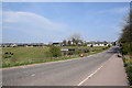
Village approach, Laurencekirk
The main road from Dundee to Aberdeen (then designated as the A94) once passed through the village but it is now thankfully bypassed to the east (as the A90).
Image: © Bill Harrison
Taken: 21 Apr 2019
0.14 miles
5
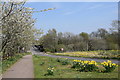
Village approach in the spring
Daffodils and blossom trees provide a nice entrance to the village of Laurencekirk.
Image: © Bill Harrison
Taken: 21 Apr 2019
0.14 miles
6
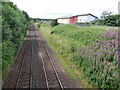
Rail track south from Blackiemuir Avenue bridge
UP-line from Aberdeen to Edinburgh/Glasgow via Laurencekirk. The large building on the right is a recently built NHS Medical Resource Centre.
Image: © Stanley Howe
Taken: 12 Jul 2017
0.17 miles
7
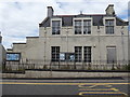
Territorial Army Centre, Laurencekirk
Originally built as a First War Drill Hall. See https://canmore.org.uk/site/331409/laurencekirk-244-high-street-drill-hall
Image: © Stanley Howe
Taken: 12 Jul 2017
0.18 miles
8
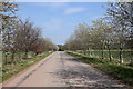
The old road
Once the A94 main road from Dundee to Aberdeen but now deserted and safe to walk down the middle to enjoy the blossom trees...
Image: © Bill Harrison
Taken: 21 Apr 2019
0.18 miles
10
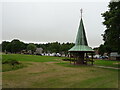
Kinnear Square, Laurencekirk
Park and recreation ground.
Image: © JThomas
Taken: 22 Jul 2021
0.18 miles