IMAGES TAKEN NEAR TO
Fordoun, LAURENCEKIRK, AB30 1LJ
Introduction
This page details the photographs taken nearby to AB30 1LJ by members of the Geograph project.
The Geograph project started in 2005 with the aim of publishing, organising and preserving representative images for every square kilometre of Great Britain, Ireland and the Isle of Man.

There are currently over 7.5m images from over14,400 individuals and you can help contribute to the project by visiting https://www.geograph.org.uk
Image Map
Images are licensed for reuse under creativecommons.org/licenses/by-sa/2.0
Notes
- Clicking on the map will re-center to the selected point.
- The higher the marker number, the further away the image location is from the centre of the postcode.
Image Listing (3 Images Found)
Images are licensed for reuse under creativecommons.org/licenses/by-sa/2.0
Image
Details
Distance
1
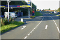
Gleaner Fuel Stop, Fiddes Bridge Service Station
Image: © David Dixon
Taken: 24 Sep 2018
0.00 miles
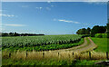
2
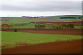
Fields at Fiddes
What appear to be drumlins along the valley of Forthie Water, which flows into Bervie water. The Hill of Gyratesmire is in the distance.
Image: © Mike Pennington
Taken: 4 May 2009
0.15 miles