
IMAGES TAKEN NEAR TO
Hunter Place, ABERDEEN, AB24 5NF
Introduction
This page details the photographs taken nearby to Hunter Place, AB24 5NF by members of the Geograph project.
The Geograph project started in 2005 with the aim of publishing, organising and preserving representative images for every square kilometre of Great Britain, Ireland and the Isle of Man.

There are currently over 7.5m images from over14,400 individuals and you can help contribute to the project by visiting https://www.geograph.org.uk
Image Map
Images are licensed for reuse under creativecommons.org/licenses/by-sa/2.0
Notes
- Clicking on the map will re-center to the selected point.
- The higher the marker number, the further away the image location is from the centre of the postcode.
Image Listing (59 Images Found)
Images are licensed for reuse under creativecommons.org/licenses/by-sa/2.0
Image
Details
Distance
1
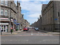
Looking down Urquhart Street, Aberdeen
Lots of student flats...
Image: © Bill Harrison
Taken: 12 May 2013
0.04 miles
2
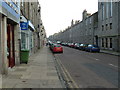
Urquhart Road, Aberdeen
Granite and satellite dishes as far as the eye can see...
Image: © Bill Harrison
Taken: 19 Nov 2011
0.05 miles
3

Rhodesia Buildings, Urquhart Road, Aberdeen
The four-storey terrace has 1909 on the datestone.
Image: © Bill Harrison
Taken: 12 May 2013
0.08 miles
4
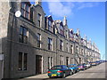
Tenements in Urquhart Street, Aberdeen
Image: © Richard Slessor
Taken: 15 Feb 2006
0.08 miles
5
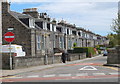
Looking down Roslin Terrace, Aberdeen
Houses only on one side, as it faces the railway.
Image: © Bill Harrison
Taken: 12 May 2013
0.09 miles
6
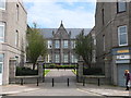
Former King Street Public (Primary) School
Built ca. 1882 after the 1872 Act made elementary school attendance compulsory:
http://en.wikipedia.org/wiki/Elementary_Education_Act_1870 . B-listed: http://www.britishlistedbuildings.co.uk/sc-48284-338-king-street-merkland-south-building-f . Now a satellite teaching unit for Robert Gordon University.
Image: © Bill Harrison
Taken: 12 May 2013
0.10 miles
7

Seaforth Road, Aberdeen
Council houses on Seaforth Road, near Pittodrie Stadium.
Image: © Charlotte Lunn
Taken: 26 Sep 2009
0.12 miles
8
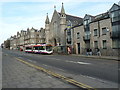
On the Buses
A First Aberdeen red-line (No. 2) service pauses at King Street and Urquhart Road.
Image: © Bill Harrison
Taken: 19 Nov 2011
0.12 miles
9
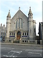
King's Community Church, King Street, Aberdeen
Originally St Andrews Free Church. As early as 1909, it merged with Nelson Street UF Church (see: http://www.geograph.org.uk/photo/3457009 ), when it was renamed King Street UF Church.
Image: © Bill Harrison
Taken: 19 Nov 2011
0.12 miles
10

King Street shops
This is part of the last block of shops with flats above as you head north on King Street. From left-to-right: closed bakers and café, African hairdressers, beauty salon, barbers.
Image: © Bill Harrison
Taken: 16 Aug 2014
0.13 miles