1
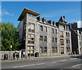
Urquhart Road, Aberdeen
Granite and satellite dishes as far as the eye can see...
Image: © Bill Harrison
Taken: 19 Nov 2011
0.02 miles
2
Looking down Urquhart Street, Aberdeen
Lots of student flats...
Image: © Bill Harrison
Taken: 12 May 2013
0.03 miles
3
Looking down Roslin Terrace, Aberdeen
Houses only on one side, as it faces the railway.
Image: © Bill Harrison
Taken: 12 May 2013
0.04 miles
4
Former King Street Public (Primary) School
Built ca. 1882 after the 1872 Act made elementary school attendance compulsory:
http://en.wikipedia.org/wiki/Elementary_Education_Act_1870 . B-listed: http://www.britishlistedbuildings.co.uk/sc-48284-338-king-street-merkland-south-building-f . Now a satellite teaching unit for Robert Gordon University.
Image: © Bill Harrison
Taken: 12 May 2013
0.04 miles
5
On the Buses
A First Aberdeen red-line (No. 2) service pauses at King Street and Urquhart Road.
Image: © Bill Harrison
Taken: 19 Nov 2011
0.06 miles
6
King's Community Church, King Street, Aberdeen
Originally St Andrews Free Church. As early as 1909, it merged with Nelson Street UF Church (see: http://www.geograph.org.uk/photo/3457009 ), when it was renamed King Street UF Church.
Image: © Bill Harrison
Taken: 19 Nov 2011
0.06 miles
7
King Street shops
This is part of the last block of shops with flats above as you head north on King Street. From left-to-right: closed bakers and café, African hairdressers, beauty salon, barbers.
Image: © Bill Harrison
Taken: 16 Aug 2014
0.06 miles
8
Suburban Parade
Heading north, the last block of shops with flats above on King Street.
Image: © Bill Harrison
Taken: 19 Nov 2011
0.06 miles
9
Sheltered housing complex, King Street, Aberdeen
Image: © Bill Harrison
Taken: 19 Nov 2011
0.08 miles
10
New flats, King Street, Aberdeen
A pretty good effort to complement the nearby granite buildings.
Image: © Bill Harrison
Taken: 16 Aug 2014
0.08 miles


