1
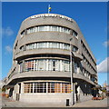
Tenements on Great Northern Road
This row of tenements lies opposite Kittybrewster Primary School. The block furthest to the right bears the date 1895.
Image: © Richard Slessor
Taken: 24 Nov 2006
0.02 miles
2
Old Boundary Marker on Clifton Road, Aberdeen
March Stone on west side of Clifton Road, Aberdeen, against stone wall opposite No 12. Legend on front face is 56 / ABD.
There are two sets of boundary stones: the inner and the outer. The inner march stones displaying CR mark the boundary of the crofts that ringed the medieval Royal Burgh of Aberdeen. The numbered outer march stones define a much larger area known as the Freedom Lands. These lands went on to become the right and responsibility of the medieval and later Royal Burgh of Aberdeen. The name 'march stones' derives from the 16th century meaning of march as a boundary.
See https://www.aberdeencity.gov.uk/services/planning-and-building/building-conservation-and-heritage/freedom-lands-and-marches.
Milestone Society National ID: AD_ABER56pb
Image: © A Weighell
Taken: 1 May 2019
0.03 miles
3
Clifton Terrace, Aberdeen
Image: © Bill Harrison
Taken: 29 May 2009
0.03 miles
4
Suburban hairdresser...
...at the junction of Clifton Road and Lilybank Place. Kittybrewster Primary School looms in the right background.
Image: © Bill Harrison
Taken: 22 Feb 2024
0.03 miles
5
All change at Kittybrewster
The outdoor cattle market at Kittybrewster ca. 1965. The Northern Hotel (still very much in business) is in the left background and the hulk of the now-demolished Astoria Cinema is in the middle background. Housing now occupies the site.
Image: © Alan Johnstone collection
Taken: Unknown
0.05 miles
6
Great Northern Road, Aberdeen
This stretch of Great Northern Road is close to the Northern Hotel. The tenements in the distance are in the next grid square (see
Image ).
Image: © Richard Slessor
Taken: 24 Nov 2006
0.06 miles
7
The Northern Hotel, Great Northern Road, Aberdeen
A-listed art-deco hotel from 1938: http://www.britishlistedbuildings.co.uk/sc-20331-1-great-northern-road-the-northern-hotel- .
Image: © Bill Harrison
Taken: 16 Mar 2014
0.06 miles
8
Art Deco Northern Hotel, entrance, Great Northern Road - Clifton Road East, Aberdeen
Entrance to the hotel. For more details see here:
Image
Image: © Alan Cooper
Taken: Unknown
0.06 miles
9
Art Deco Northern Hotel, Great Northern Road - Clifton Road East, Aberdeen
The art deco Aberdeen Northern Hotel was built in 1939 and is an A listed building. On the outside it has all the original features and inside the ballroom boasts the only violin shaped hall and one of the largest dance floors in Aberdeen. The Ellington bar area looks original as well. Web site: http://www.aberdeennorthernhotel.com/index.html with photos and "virtual tours". Another photo here:
Image and a close up of the entrance here:
Image
Image: © Alan Cooper
Taken: Unknown
0.07 miles
10
Northern Hotel
A splendid art-deco building, dating from 1937-8.
Image: © Bill Harrison
Taken: 11 Aug 2008
0.07 miles


