Old Boundary Marker on Clifton Road, Aberdeen
Introduction
The photograph on this page of Old Boundary Marker on Clifton Road, Aberdeen by A Weighell as part of the Geograph project.
The Geograph project started in 2005 with the aim of publishing, organising and preserving representative images for every square kilometre of Great Britain, Ireland and the Isle of Man.

There are currently over 7.5m images from over 14,400 individuals and you can help contribute to the project by visiting https://www.geograph.org.uk
Old Boundary Marker on Clifton Road, Aberdeen
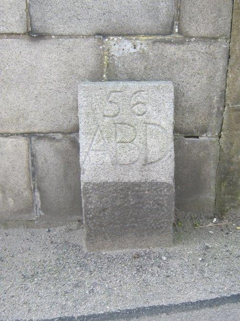
Image: © A Weighell Taken: 1 May 2019
March Stone on west side of Clifton Road, Aberdeen, against stone wall opposite No 12. Legend on front face is 56 / ABD. There are two sets of boundary stones: the inner and the outer. The inner march stones displaying CR mark the boundary of the crofts that ringed the medieval Royal Burgh of Aberdeen. The numbered outer march stones define a much larger area known as the Freedom Lands. These lands went on to become the right and responsibility of the medieval and later Royal Burgh of Aberdeen. The name 'march stones' derives from the 16th century meaning of march as a boundary. See https://www.aberdeencity.gov.uk/services/planning-and-building/building-conservation-and-heritage/freedom-lands-and-marches. Milestone Society National ID: AD_ABER56pb
Images are licensed for reuse under creativecommons.org/licenses/by-sa/2.0
Image Location
Latitude
57.162506
Longitude
-2.117302