
IMAGES TAKEN NEAR TO
Anderson Avenue, ABERDEEN, AB24 4NF
Introduction
This page details the photographs taken nearby to Anderson Avenue, AB24 4NF by members of the Geograph project.
The Geograph project started in 2005 with the aim of publishing, organising and preserving representative images for every square kilometre of Great Britain, Ireland and the Isle of Man.

There are currently over 7.5m images from over14,400 individuals and you can help contribute to the project by visiting https://www.geograph.org.uk
Image Map
Images are licensed for reuse under creativecommons.org/licenses/by-sa/2.0
Notes
- Clicking on the map will re-center to the selected point.
- The higher the marker number, the further away the image location is from the centre of the postcode.
Image Listing (35 Images Found)
Images are licensed for reuse under creativecommons.org/licenses/by-sa/2.0
Image
Details
Distance
1
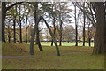
Stewart Park, Hilton, Aberdeen
Not Aberdeen's best known park, but it still has its own Wikipedia page: http://en.wikipedia.org/wiki/Stewart_Park,_Aberdeen . Note the whalebone arch in the foreground.
Image: © Bill Harrison
Taken: 11 Oct 2014
0.12 miles
2
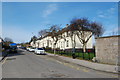
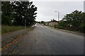
Looking up Smithfield Road
Some classic Aberdeen maisonettes to the right.
Image: © Bill Harrison
Taken: 20 Apr 2013
0.13 miles
3
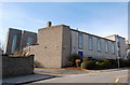
All Saints' Episcopal Church, Smithfield Road
A rare example of a 1930s-built church in Aberdeen and B-listed: http://www.britishlistedbuildings.co.uk/sc-19935-all-saints-episcopal-church-smithield-roa .
Image: © Bill Harrison
Taken: 20 Apr 2013
0.13 miles
5
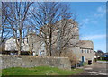
All Saints' Episcopal Church
Built 1935; view from the south west towards the nave.
Image: © Bill Harrison
Taken: 20 Apr 2013
0.14 miles
7
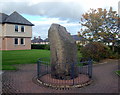
Lang Stane, Hilton Drive, Aberdeen
This scheduled monument (see: http://data.historic-scotland.gov.uk/pls/htmldb/f?p=2300:35:3130637056466331::NO::P35_SELECTED_MONUMENT:4263 ) is thought to date from the Bronze Age and now occupies the courtyard of a sheltered housing complex. It is not to be confused with another Aberdeen lang stane, which is built into the wall of a building on Dee Street in the city centre.
Image: © Bill Harrison
Taken: 11 Oct 2014
0.15 miles
9
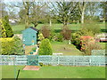
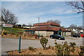
Garden and Stewart Park, Aberdeen
My garden and Stewart Park taken from Middlefield Terrace, Aberdeen
Image: © Steven Brown
Taken: 2 May 2005
0.18 miles
10
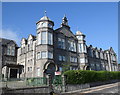
Woodside Primary School
Built 1902 and still looking good. School roll (2017-18): 342. See Canmore record 174291: https://canmore.org.uk/site/174291/aberdeen-clifton-road-woodside-elementary-school .
Image: © Bill Harrison
Taken: 26 Jul 2018
0.19 miles