1
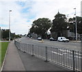
Sunnybank Place off Sunnybank Road, Aberdeen
Image: © Ian S
Taken: 5 Oct 2022
0.04 miles
2
Elmbank Terrace, Aberdeen
Image: © Bill Harrison
Taken: 5 Feb 2012
0.05 miles
3
March Stone No. 58, Elmbank Terrace, Aberdeen
The March Stones mark the "Freedom Lands and Marches of Aberdeen." For their history, see the excellent guide produced by the City of Aberdeen: http://www.aberdeencity.gov.uk/web/files/LocalHistory/march_stones_01.pdf . There was a march (boundary) stone here in 1780 (long before housing was built), but the present stone dates from the 1920s. Most of the stones, including this one, are B-listed: http://www.britishlistedbuildings.co.uk/sc-20038-march-stone-no-58-in-front-garden-wall-of
Image: © Bill Harrison
Taken: 8 Sep 2012
0.05 miles
4
Elmbank Road off Sunnybank Place, Aberdeen
Image: © Ian S
Taken: 5 Oct 2022
0.05 miles
5
Elmbank Road, Aberdeen
Image: © Bill Harrison
Taken: 5 Feb 2012
0.05 miles
6
Granite suburban (Elmbank Road, Aberdeen)
Fine granite terraces dating from around 1900 and still looking as good as new.
Image: © Bill Harrison
Taken: 18 Oct 2014
0.06 miles
7
Granite block, Elmbank Terrace, Aberdeen
An utterly typical granite Aberdeen tenement block with prominent chimney stacks in the front facade. This one was built in 1893 and is still looking in fine shape, although the satellite dishes do nothing to enhance its appearance.
Image: © Bill Harrison
Taken: 5 Feb 2012
0.09 miles
8
Sunnyside Road, Aberdeen
Sunnyside Road is a residential road in the inner suburbs of Aberdeen. Signs indicate that it is a "no through road".
Image: © Malc McDonald
Taken: 29 Apr 2023
0.09 miles
9
Powis Place/Causewayend, Aberdeen
Powis Place, which changes name to Causewayend about half way down, was turned into a dual carriageway in the 1960s amid wholescale residential demolition. The former Powis Church (now flats) lurks behind the trees in the right foreground and the cupola of St Stephen's Church (originally Causewayend Free Church) is just visible in the background.
Image: © Bill Harrison
Taken: 21 Sep 2013
0.10 miles
10
Winter view down Froghall Avenue, Aberdeen
1930s rendered council flats.
Image: © Bill Harrison
Taken: 5 Feb 2012
0.11 miles


