
IMAGES TAKEN NEAR TO
Great Northern Road, ABERDEEN, AB24 2GG
Introduction
This page details the photographs taken nearby to Great Northern Road, AB24 2GG by members of the Geograph project.
The Geograph project started in 2005 with the aim of publishing, organising and preserving representative images for every square kilometre of Great Britain, Ireland and the Isle of Man.

There are currently over 7.5m images from over14,400 individuals and you can help contribute to the project by visiting https://www.geograph.org.uk
Image Map
Images are licensed for reuse under creativecommons.org/licenses/by-sa/2.0
Notes
- Clicking on the map will re-center to the selected point.
- The higher the marker number, the further away the image location is from the centre of the postcode.
Image Listing (52 Images Found)
Images are licensed for reuse under creativecommons.org/licenses/by-sa/2.0
Image
Details
Distance
1
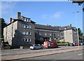
Flats
Were these big 1930s blocks (with replacement windows) of former council flats on Great Northern Road inspired by continental "workers' settlements"?
Image: © Bill Harrison
Taken: 26 Jul 2018
0.05 miles
2
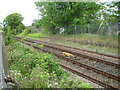
Woodside railway station (site), Aberdeenshire, 2017
Opened in 1858 on the Great North of Scotland Railway's line from Aberdeen to Keith, this station closed to passengers in 1937.
View west towards Bucksburn and Keith. A year after this image was taken, the line was redoubled and nearly all trace of the old platforms seen here has now gone.
Image: © Nigel Thompson
Taken: 24 May 2017
0.05 miles
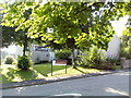
4
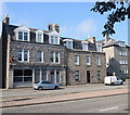
Crown Bar, Great Northern Road, Aberdeen
Image: © Bill Harrison
Taken: 26 Jul 2018
0.06 miles
5
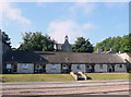
Sheltered housing (Great Northern Road, Aberdeen)
The former St John's UF church (now offices) looms behind them: http://www.geograph.org.uk/photo/3435518 .
Image: © Bill Harrison
Taken: 26 Jul 2018
0.06 miles
6
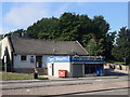
612 Club (and Noor's Grill), Great Northern Road, Aberdeen
Image: © Bill Harrison
Taken: 26 Jul 2018
0.07 miles
7
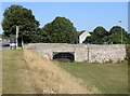
Bridge over the course of the former Aberdeenshire canal
Image: © Bill Harrison
Taken: 26 Jul 2018
0.07 miles
8
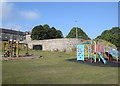
Bridge to nowhere
Bridge over the former Aberdeenshire canal (see the excellent Wikipedia page: https://en.wikipedia.org/wiki/Aberdeenshire_Canal ), which opened around 1805 and closed in 1854, to be replaced by the railway, which runs about 50 metres to the north at this point. See Canmore record 141088 for more: https://canmore.org.uk/site/141088/aberdeen-woodside-aberdeenshire-canal-bridge .
Image: © Bill Harrison
Taken: 26 Jul 2018
0.08 miles
9
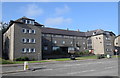
Flats
One of several large blocks of ex-council flats facing onto Great Northern Road.
Image: © Bill Harrison
Taken: 26 Jul 2018
0.08 miles
10
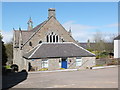
Former St Johns United Free Church.
Built ca. 1881 as Woodside United Presbyterian Church and renamed in 1900 to St Johns UF Church to not conflict with Woodside Free Church down the road (which was renamed to Hilton UF Church). Now offices.
Image: © Bill Harrison
Taken: 28 Apr 2013
0.09 miles