Bridge to nowhere
Introduction
The photograph on this page of Bridge to nowhere by Bill Harrison as part of the Geograph project.
The Geograph project started in 2005 with the aim of publishing, organising and preserving representative images for every square kilometre of Great Britain, Ireland and the Isle of Man.

There are currently over 7.5m images from over 14,400 individuals and you can help contribute to the project by visiting https://www.geograph.org.uk
Bridge to nowhere
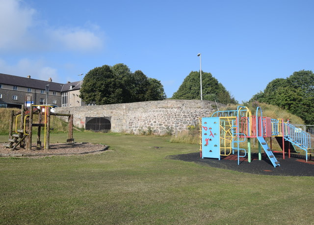
Image: © Bill Harrison Taken: 26 Jul 2018
Bridge over the former Aberdeenshire canal (see the excellent Wikipedia page: https://en.wikipedia.org/wiki/Aberdeenshire_Canal ), which opened around 1805 and closed in 1854, to be replaced by the railway, which runs about 50 metres to the north at this point. See Canmore record 141088 for more: https://canmore.org.uk/site/141088/aberdeen-woodside-aberdeenshire-canal-bridge .
Images are licensed for reuse under creativecommons.org/licenses/by-sa/2.0
Image Location
Latitude
57.172042
Longitude
-2.130794