
IMAGES TAKEN NEAR TO
Marshall Mackenzie Road, ABERDEEN, AB21 0AB
Introduction
This page details the photographs taken nearby to Marshall Mackenzie Road, AB21 0AB by members of the Geograph project.
The Geograph project started in 2005 with the aim of publishing, organising and preserving representative images for every square kilometre of Great Britain, Ireland and the Isle of Man.

There are currently over 7.5m images from over14,400 individuals and you can help contribute to the project by visiting https://www.geograph.org.uk
Image Map
Images are licensed for reuse under creativecommons.org/licenses/by-sa/2.0
Notes
- Clicking on the map will re-center to the selected point.
- The higher the marker number, the further away the image location is from the centre of the postcode.
Image Listing (12 Images Found)
Images are licensed for reuse under creativecommons.org/licenses/by-sa/2.0
Image
Details
Distance
1
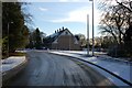
Kingseat Meadows
A development in progress, forming a modern village from a mix of old and new properties.
Image: © John Allan
Taken: 6 Feb 2007
0.04 miles
2
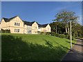
The edge of the Kingseat Development
Kingseat is a rural development of new-build homes located to the SE of Newmachar.
Image: © David Robinson
Taken: 3 Aug 2019
0.11 miles
5
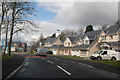
Too new for the map
Some of the new-builds at the Kingseat Meadows development.
Image: © Bill Harrison
Taken: 28 Apr 2012
0.13 miles
6
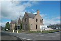
Former Hospital Administration Building, Kingseat
The Kingseat site was the first "village hospital" in the UK, inspired by European examples. It treated casualties from Atlantic Convoys in WWII and was later used as a residential mental-health facility.
For more on its interesting history, see: http://www.aberdeenshire.gov.uk/planning/devbriefs/KingseatBriefFeb03.pdf (warning: large file, 4MByte). The road has the impressive name of King Malcolm Drive, because King Malcolm reputedly stopped in the area after defeating Macbeth at the battle of Lumphanen in 1057.
Image: © Bill Harrison
Taken: 28 Apr 2012
0.14 miles
7
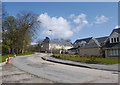
Bacchanate Way, Kingseat Meadows, Aberdeenshire
Some of the new-build houses on the Kingseat development.
Image: © Bill Harrison
Taken: 28 Apr 2012
0.16 miles
9
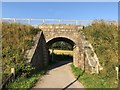
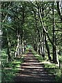
Footpath between Newmachar and Kingseat
Footpath passing under a granite bridge carrying the former railway from Aberdeen to Peterhead & Fraserburgh, now the Formartine & Buchan Way pedestrian and cycle route.
Image: © David Robinson
Taken: 3 Aug 2019
0.23 miles
