IMAGES TAKEN NEAR TO
Huxterstone Drive, ABERDEEN, AB15 8UN
Introduction
This page details the photographs taken nearby to Huxterstone Drive, AB15 8UN by members of the Geograph project.
The Geograph project started in 2005 with the aim of publishing, organising and preserving representative images for every square kilometre of Great Britain, Ireland and the Isle of Man.

There are currently over 7.5m images from over14,400 individuals and you can help contribute to the project by visiting https://www.geograph.org.uk
Image Map
Images are licensed for reuse under creativecommons.org/licenses/by-sa/2.0
Notes
- Clicking on the map will re-center to the selected point.
- The higher the marker number, the further away the image location is from the centre of the postcode.
Image Listing (15 Images Found)
Images are licensed for reuse under creativecommons.org/licenses/by-sa/2.0
Image
Details
Distance
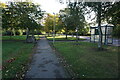
3
Turf Zone "Huxterstone"
At Kingswood Drive, Kingswells.
Image: © Ian S
Taken: 6 Oct 2022
0.08 miles
4
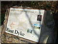
East Dyke
Kingswells Consumption Dykes information board.
Image: © Stanley Howe
Taken: 8 Nov 2007
0.15 miles
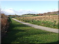
5
Turf Zone "KingsDyke"
Kingswood Drive, Kingshills
Image: © Ian S
Taken: 6 Oct 2022
0.16 miles
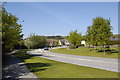
9
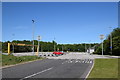
Kingswells Park and Ride
The car park, which should be full of Saturday shoppers' cars, is almost empty in the coronavirus crisis of 2020. The red car had a sticker on its windscreen declaring it to be 'abandoned and subject to destruction'.
Image: © Bill Harrison
Taken: 30 May 2020
0.18 miles
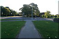
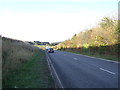
10
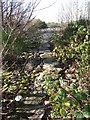
Path along the top of East Dyke
Believed to be of late 19th century construction. The dyke was made of stones cleared from the land to facilitate agriculture.
Image: © Stanley Howe
Taken: 8 Nov 2007
0.18 miles