IMAGES TAKEN NEAR TO
Springfield Lane, ABERDEEN, AB15 8JE
Introduction
This page details the photographs taken nearby to Springfield Lane, AB15 8JE by members of the Geograph project.
The Geograph project started in 2005 with the aim of publishing, organising and preserving representative images for every square kilometre of Great Britain, Ireland and the Isle of Man.

There are currently over 7.5m images from over14,400 individuals and you can help contribute to the project by visiting https://www.geograph.org.uk
Image Map
Images are licensed for reuse under creativecommons.org/licenses/by-sa/2.0
Notes
- Clicking on the map will re-center to the selected point.
- The higher the marker number, the further away the image location is from the centre of the postcode.
Image Listing (66 Images Found)
Images are licensed for reuse under creativecommons.org/licenses/by-sa/2.0
Image
Details
Distance
1
Bungalow on the corner of Springfield Road/Avenue
Image: © Stanley Howe
Taken: 11 Apr 2009
0.03 miles
3
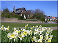
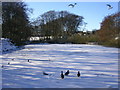
Daffodils on Springfield Road, Aberdeen
This has been taken from the open space next to the Walker Dam. Springfield Avenue is the road on the right of the picture and it leads to Johnston Gardens.
Image: © Richard Slessor
Taken: 19 Apr 2006
0.10 miles
6
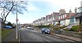
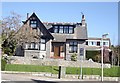
Springfield Avenue, Hill of Rubislaw
A residential suburb of Aberdeen; 20mph speed restriction with street parking permitted.
Image: © Stanley Howe
Taken: 22 Mar 2018
0.12 miles
8
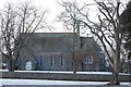
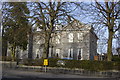
Craigiebuckler Kirk
Yet another view of this church built in 1883 and B-listed: http://www.britishlistedbuildings.co.uk/sc-19938-craigiebuckler-church-c-of-s-springfield- (although it looks like a rather generic Victorian style to me). It must have been in the countryside when built, but it has long been absorbed by Aberdeen suburbs.
Image: © Bill Harrison
Taken: 10 Mar 2013
0.13 miles
9
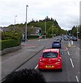
Queen's Road traffic lights
At junction with Springfield Road, Hazlehead, Aberdeen.
Image: © Stanley Howe
Taken: 30 May 2015
0.14 miles
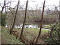
10
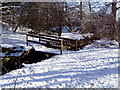
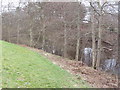
Footbridge over Rubislaw burn
From the back of Johnston Gardens there is a footpath up to the Craigiebuckler estate.
Image: © Ewen Rennie
Taken: 21 Feb 2010
0.14 miles