IMAGES TAKEN NEAR TO
The Paddock, PETERCULTER, AB14 0UE
Introduction
This page details the photographs taken nearby to The Paddock, AB14 0UE by members of the Geograph project.
The Geograph project started in 2005 with the aim of publishing, organising and preserving representative images for every square kilometre of Great Britain, Ireland and the Isle of Man.

There are currently over 7.5m images from over14,400 individuals and you can help contribute to the project by visiting https://www.geograph.org.uk
Image Map
Images are licensed for reuse under creativecommons.org/licenses/by-sa/2.0
Notes
- Clicking on the map will re-center to the selected point.
- The higher the marker number, the further away the image location is from the centre of the postcode.
Image Listing (56 Images Found)
Images are licensed for reuse under creativecommons.org/licenses/by-sa/2.0
Image
Details
Distance
2
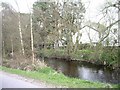
Tail race of Upper Kennerty Mills
See Image for the mill buildings.
Image: © Stephen Craven
Taken: 2 Jul 2019
0.04 miles
3
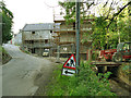
Upper Kennerty Mills, scaffolded (1)
A historic former water-powered grain mill on the Culter Burn. Existing buildings are dated 1838 and 1943 but incorporate earlier masonry. Listed category B (LB15717).
Image: © Stephen Craven
Taken: 2 Jul 2019
0.05 miles
4
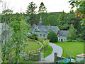
Lower Kennerty Mill
A historic oatmeal mill on the Culter Burn, ruined in 1880 but reconstructed as a barley mill. After it ceased to be used as a mill in 1916 it was used as an engineering works. Rebuilt again 1940 and in operation briefly until November 1941. (Precis of listing). Listed category C (LB15718). Viewed from the Deeside Way.
Image: © Stephen Craven
Taken: 2 Jul 2019
0.06 miles
5
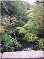
Looking downstream Culter Burn
From Kennerty bridge.
Image: © Stanley Howe
Taken: 4 Oct 2007
0.06 miles
8
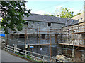
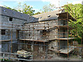
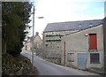
Upper Kennerty Mills, scaffolded (2)
A historic former water-powered grain mill on the Culter Burn. Existing buildings are dated 1838 and 1943 but incorporate earlier masonry. Listed category B (LB15717).
Image: © Stephen Craven
Taken: 2 Jul 2019
0.06 miles
9
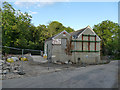
Upper Kennerty Mills
A historic former water-powered grain mill on the Culter Burn. Existing buildings are dated 1838 and 1943 (the latter date appears on the left-hand gable in this view) but incorporate earlier masonry. Partly demolished since this 2010 view Image which gives the full name of the business. Listed category B (LB15717).
Image: © Stephen Craven
Taken: 2 Jul 2019
0.06 miles