Upper Kennerty Mills
Introduction
The photograph on this page of Upper Kennerty Mills by Stephen Craven as part of the Geograph project.
The Geograph project started in 2005 with the aim of publishing, organising and preserving representative images for every square kilometre of Great Britain, Ireland and the Isle of Man.

There are currently over 7.5m images from over 14,400 individuals and you can help contribute to the project by visiting https://www.geograph.org.uk
Upper Kennerty Mills
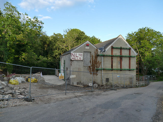
Image: © Stephen Craven Taken: 2 Jul 2019
A historic former water-powered grain mill on the Culter Burn. Existing buildings are dated 1838 and 1943 (the latter date appears on the left-hand gable in this view) but incorporate earlier masonry. Partly demolished since this 2010 view Image which gives the full name of the business. Listed category B (LB15717).
Images are licensed for reuse under creativecommons.org/licenses/by-sa/2.0
Image Location
Latitude
57.094829
Longitude
-2.272282